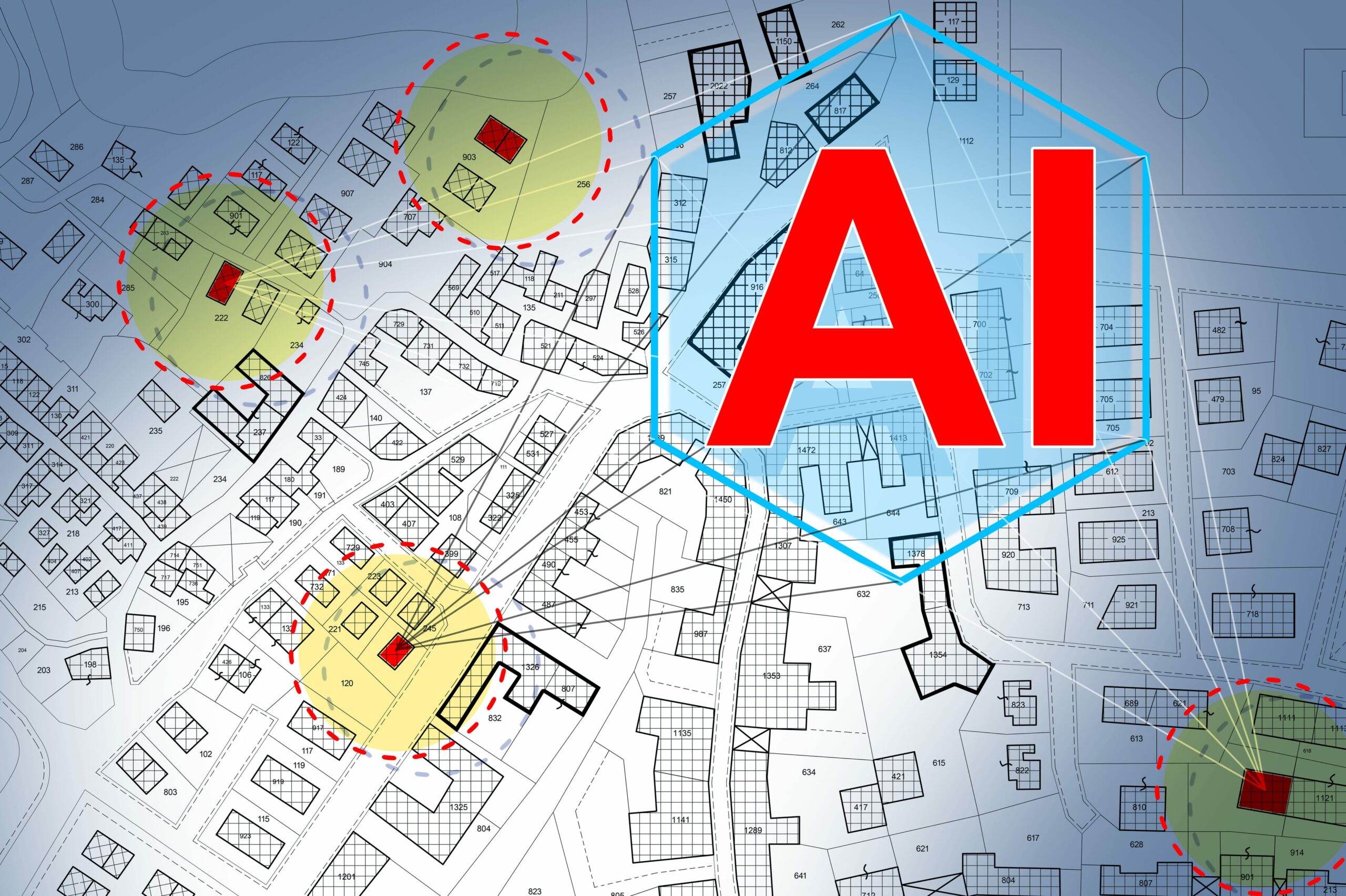
In the rapidly evolving technological landscape, the fusion of Light Detection and Ranging (LiDAR) and Artificial Intelligence (AI) is heralding a new era of innovation and efficiency. This synergy is not just enhancing our understanding of the physical world but is also redefining our interaction with it. At the heart of this revolution is Magnasoft, a company that has positioned itself at the vanguard of integrating these cutting-edge technologies. By harnessing the power of LiDAR and AI, Magnasoft is delivering unparalleled geospatial insights, driving industries such as utilities, transportation, and urban planning towards a smarter and more sustainable future.
The Fusion of LiDAR and AI: A Game-Changer
LiDAR technology has long been recognized for its ability to generate precise 3D representations of physical environments. By emitting millions of laser pulses and measuring the time it takes for them to return, LiDAR creates detailed point clouds that form the foundation for geospatial mapping and analysis. However, the true potential of LiDAR data is unlocked when it is combined with the capabilities of AI, particularly in the realms of computer vision and image processing.
AI algorithms are inherently data-hungry, thriving on extensive and detailed datasets to analyze, interpret, and make predictions. The rich, high-resolution datasets produced by LiDAR serve as an ideal feeding ground for these algorithms, enabling them to discern patterns and extract meaningful insights with remarkable accuracy. When AI meets LiDAR, the result is a powerful tool that can not only visualize but also understand and interact with the environment in ways previously unimaginable.
This fusion marks a significant turning point, especially in fields that rely heavily on accurate environmental modeling and analysis. The dense, precise data from LiDAR, coupled with AI’s ability to learn and adapt, creates a dynamic duo that can accurately detect objects, predict environmental changes, and model complex ecosystems with an unprecedented level of detail. This combination is proving to be a game-changer, offering a new lens through which we can view and interact with the world around us.
Automating Data Processing: From Laborious to Effortless
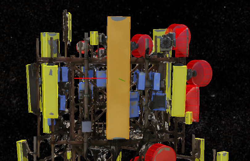
The traditional approach to LiDAR data interpretation was a daunting task. It involved an extensive manual effort to label and categorize the vast amounts of point cloud data, identifying key features such as buildings, Utility infrastructure, trees, and other landscape elements. This process was not only labor-intensive but also required a high level of specialized knowledge, making it a significant bottleneck in the workflow of geospatial analysis.
Advanced AI models equipped with sophisticated algorithms for computer vision and machine learning have taken on the challenge of automating the data labeling process. These models can swiftly navigate through the complex, unstructured data produced by LiDAR, identifying and categorizing objects with remarkable accuracy and speed. What once took hours or even days can now be accomplished in a fraction of the time, significantly streamlining the workflow and allowing for a more efficient allocation of human expertise to more critical analytical tasks.
The Impact: Precision, Efficiency, and Scalability
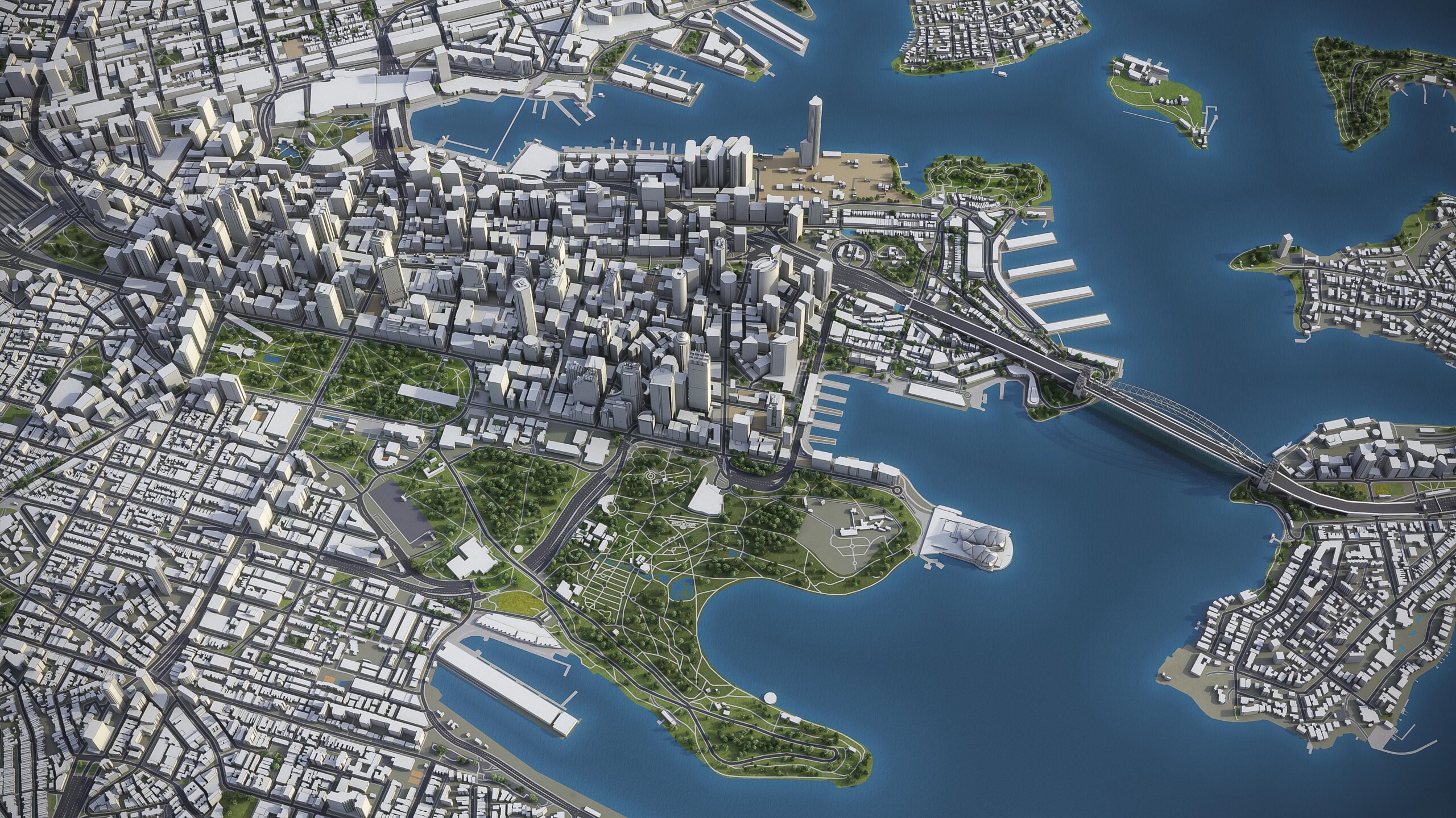
The marriage of LiDAR and AI extends beyond mere automation; it elevates the quality and utility of the insights derived from geospatial data. AI’s inherent capacity for continuous learning and adaptation means that with each dataset analyzed, the algorithms become more refined and accurate in their predictions and interpretations. This leads to the creation of 3D models that are not only highly precise but also consistently updated to reflect the latest environmental conditions.
Such advancements have a ripple effect on the scalability of projects. With AI handling the heavy lifting of data processing, it becomes feasible to tackle larger areas and more complex environments, expanding the scope of what can be achieved through geospatial analysis. This combination of precision, efficiency, and scalability is transforming the way we approach environmental modeling, making it an indispensable tool in a multitude of applications.
Transforming Industries
Utilities and Vegetation Management
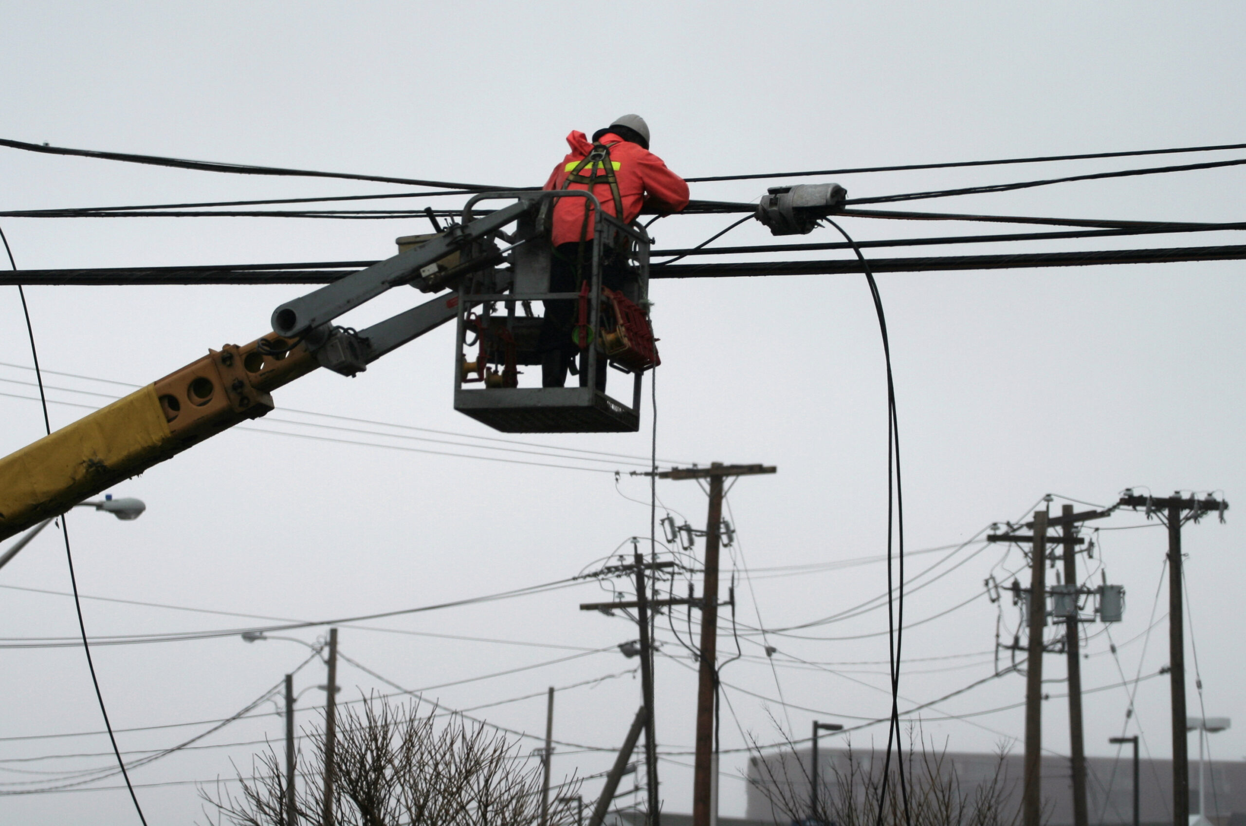
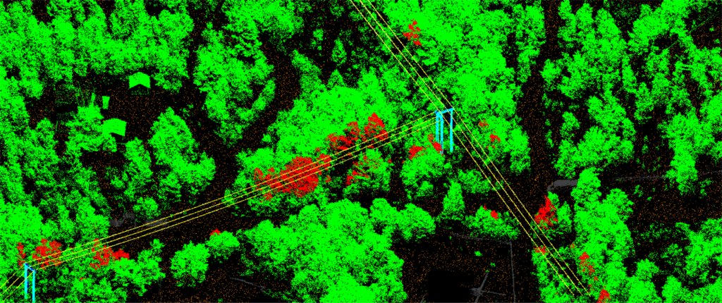
In the utilities sector, effective vegetation management around power lines is paramount for preventing outages and ensuring public safety. The integration of LiDAR and AI has brought about a significant leap forward in this area. Utility companies can now leverage these technologies to accurately predict vegetation growth patterns and identify potential encroachments on power lines. This predictive capability allows for proactive maintenance planning, reducing the likelihood of service disruptions and enhancing overall grid resilience.
Transportation and Infrastructure
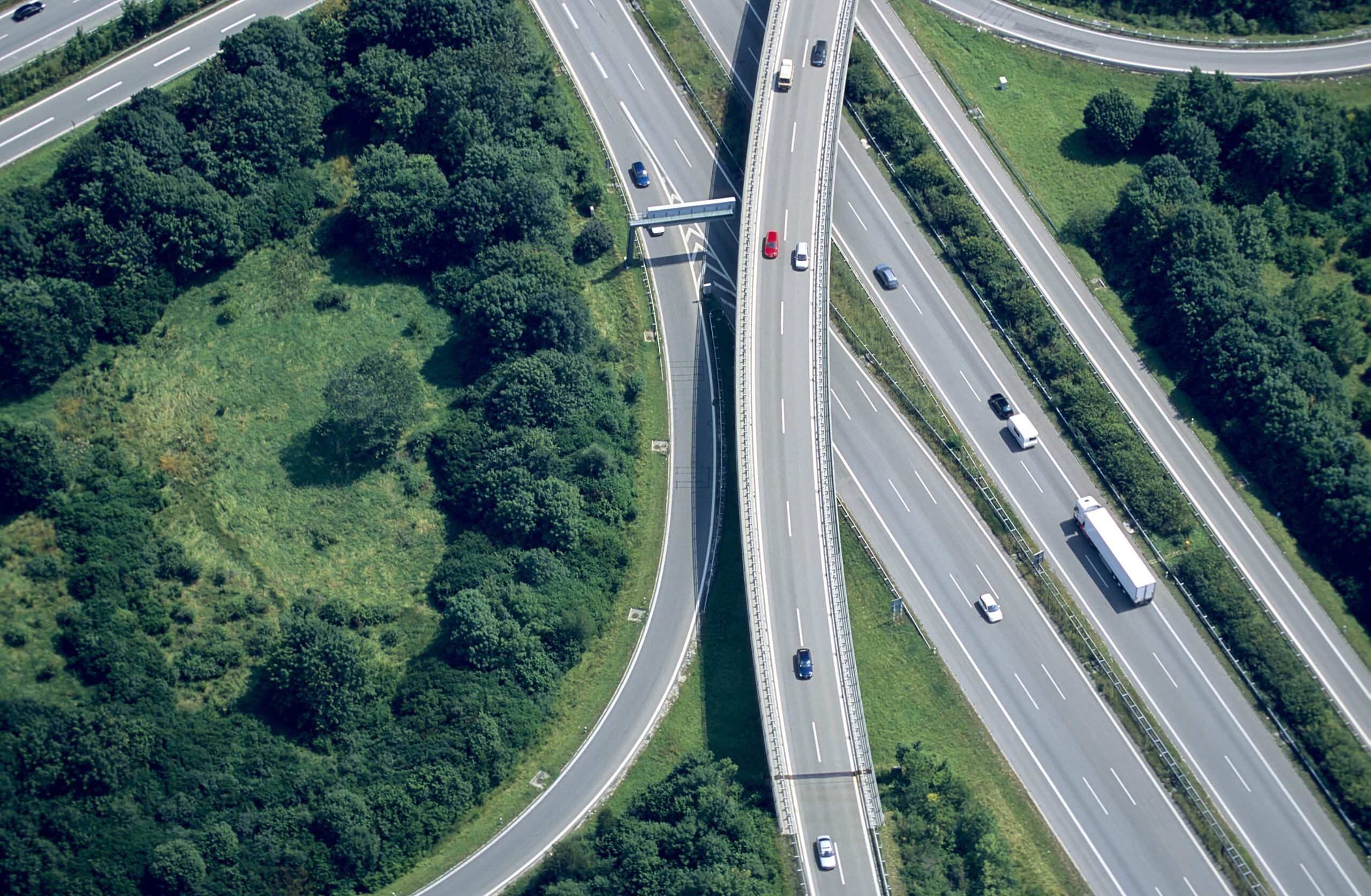
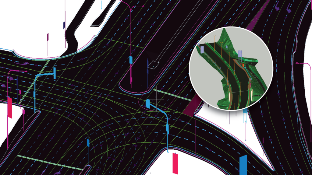
The detailed 3D models generated by LiDAR and AI are proving invaluable in the realm of transportation and infrastructure. These models provide critical insights for the planning, design, and maintenance of infrastructure, from assessing road conditions to conceptualizing new transportation networks. By enabling a more informed decision-making process, these technologies are paving the way for infrastructure that is not only more robust and efficient but also better aligned with future needs.
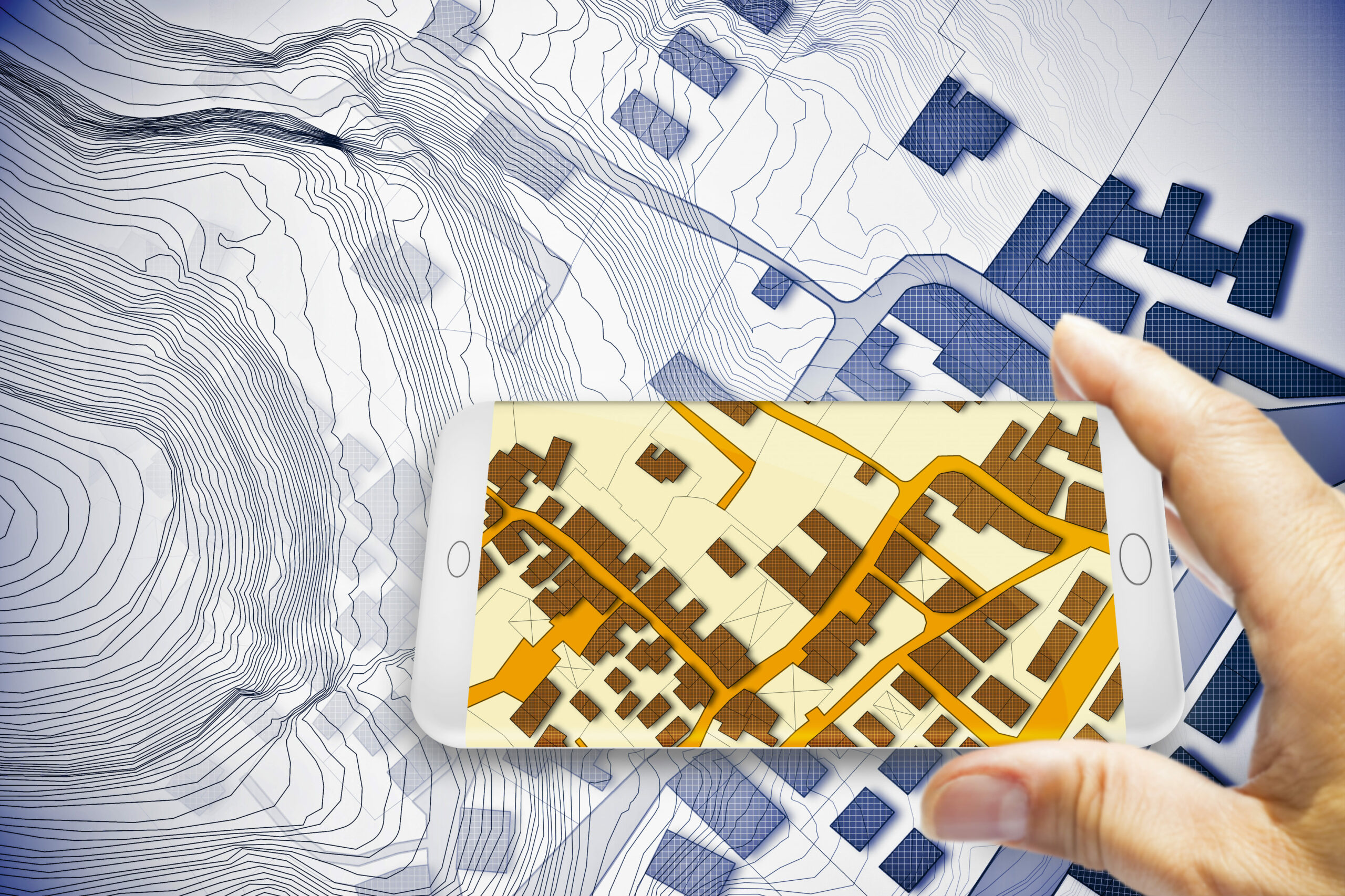
Urban Planning and Smart Cities
Urban planners are increasingly turning to LiDAR and AI to create more sustainable, livable cities. The detailed insights obtained from these technologies assist in everything from monitoring construction progress to optimizing the design of public spaces. This data-driven approach to urban planning enables the creation of environments that are finely tuned to the needs of their inhabitants, fostering communities that are both vibrant and resilient.
The Future: A World Reshaped by LiDAR and AI
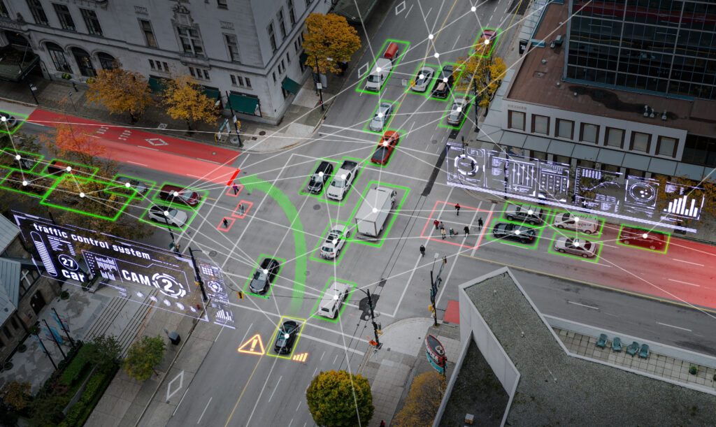
The fusion of LiDAR and AI is not the endgame but rather the beginning of a broader technological evolution. As we peer into the future, it’s clear that the integration of these technologies with other emerging innovations like the Internet of Things (IoT) and 5G connectivity promises to unlock even greater capabilities. Real-time, dynamic analysis and interaction with our environments are within reach, offering the potential to not only enhance operational efficiencies but also profoundly improve our ability to plan, adapt, and mitigate risks.
Imagine a world where smart cities leverage real-time LiDAR data, processed through AI, to manage traffic flows, monitor infrastructure health, and ensure public safety, all in the blink of an eye. The possibilities are as vast as they are exciting, representing a significant leap forward in our quest to create more connected, intelligent, and responsive environments.
Magnasoft’s Evolution: Pioneering LiDAR Data Processing for Over Two Decades
Magnasoft’s journey mirrors the evolution of LiDAR technology itself. With a legacy spanning over two decades, Magnasoft has not only witnessed but has been an integral player in the maturation of LiDAR from its nascent stages to the cutting-edge tool it is today. This deep-seated experience, coupled with a constant drive for innovation, positions Magnasoft as an unparalleled leader in the geospatial industry.
Decades of Specialization
Magnasoft’s extensive history in LiDAR data processing has fostered an unparalleled depth of knowledge and expertise. This foundation enables Magnasoft to navigate the complexities of LiDAR technology with ease, ensuring that solutions are not only grounded in a rich understanding of past and present capabilities but are also at the forefront of leveraging new advancements.
Adaptation and Growth
Throughout its history, Magnasoft has demonstrated an exceptional capacity to evolve. This adaptability is evident in the seamless integration of AI into its workflows, a move that has significantly enhanced the precision and efficiency of data processing. By staying attuned to technological advancements and embracing change, Magnasoft ensures that its services remain relevant and valuable in an ever-changing landscape.
Automation and AI Integration
Magnasoft’s commitment to innovation is perhaps most visible in its embrace of automation and AI. By automating data processing and incorporating AI-driven analysis, Magnasoft has set a new standard for speed, accuracy, and scalability in geospatial data services. This forward-thinking approach allows Magnasoft to tackle complex, large-scale projects with unparalleled efficiency, setting the stage for future advancements and applications.
Scalability and Efficiency: The Magnasoft Advantage
The challenges of modern geospatial projects often lie in their scale and the demand for rapid yet accurate, data processing. Magnasoft’s advanced AI-driven workflows represent a paradigm shift in how these challenges are addressed, offering scalability and efficiency that redefine what’s possible in geospatial analysis.
Shaping a Smarter World Together
The fusion of LiDAR and AI is just the beginning. As we look towards a future where these technologies intertwine with IoT, 5G, and beyond, the opportunities for innovation in geospatial analysis are boundless. Magnasoft is committed to leading this charge, exploring new frontiers in data analysis, and offering solutions that not only meet the needs of today but anticipate the demands of tomorrow.
Connect With Us for Deeper Insights’
For those keen on delving deeper into the transformative potential of LiDAR and AI in geospatial analysis, we invite you to reach out. Our portfolio of executed projects showcases the tangible impacts and benefits these technologies bring across various sectors. Whether you’re interested in a detailed assessment or exploring case studies that resonate with your specific needs, our team is ready to provide the insights and support you require.
Contact us today for more details and a personalized assessment. Together, let’s explore how the convergence of LiDAR and AI can revolutionize your projects and contribute to a smarter, more sustainable future.