The Benefits of Lightweight 3D Models in Collaborative Engineering

 Lightweight 3D models are a solution to this problem, as they are much smaller files that can be quickly loaded and rendered. This makes it easier for engineers to work on the same project at the same time, as they can quickly view and make changes to the design. There are many benefits to using lightweight 3D models in collaborative engineering. In this blog post, we will explore some of the most significant benefits. By the end of this post, you will understand why more and more engineers are choosing to use lightweight 3D models in their work.

The Global Model-Based Enterprise Market Is Experiencing a Boom

With a CAGR of 21.17%, the global model-based enterprise market is anticipated to grow from USD 8.1 billion in 2018 to USD 21.3 billion in 2023. Key factors driving market expansion include expanding software capabilities and broad applications of digital technologies in design and manufacturing.

Lightweight Model-Driven Engineering Concept:

The development of new MDE tools aimed at non-technical users (such as citizen developers interested in utilizing open data & big data projects) and the application of techniques to increase the effectiveness of MDE are combined in this lightweight alternative.

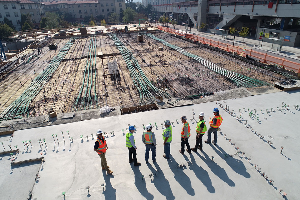
Handling huge, highly detailed 3D CAD models in collaborative engineering contexts is getting harder. In particular, file size reduction is necessary for downstream operations, sharing 3D CAD models between OEMs and suppliers, and IP (intellectual property) protection while keeping the original design intent. By enclosing, defeaturizing, and extracting inner and exterior surfaces, 3D geometry can be simplified to benefit businesses. 

Lightweight CAD models make the efficient exchange and communication of pertinent 3D product information possible since redundant and private data storage is avoided. This is a crucial foundation for practical collaborative engineering in internationally dispersed development.

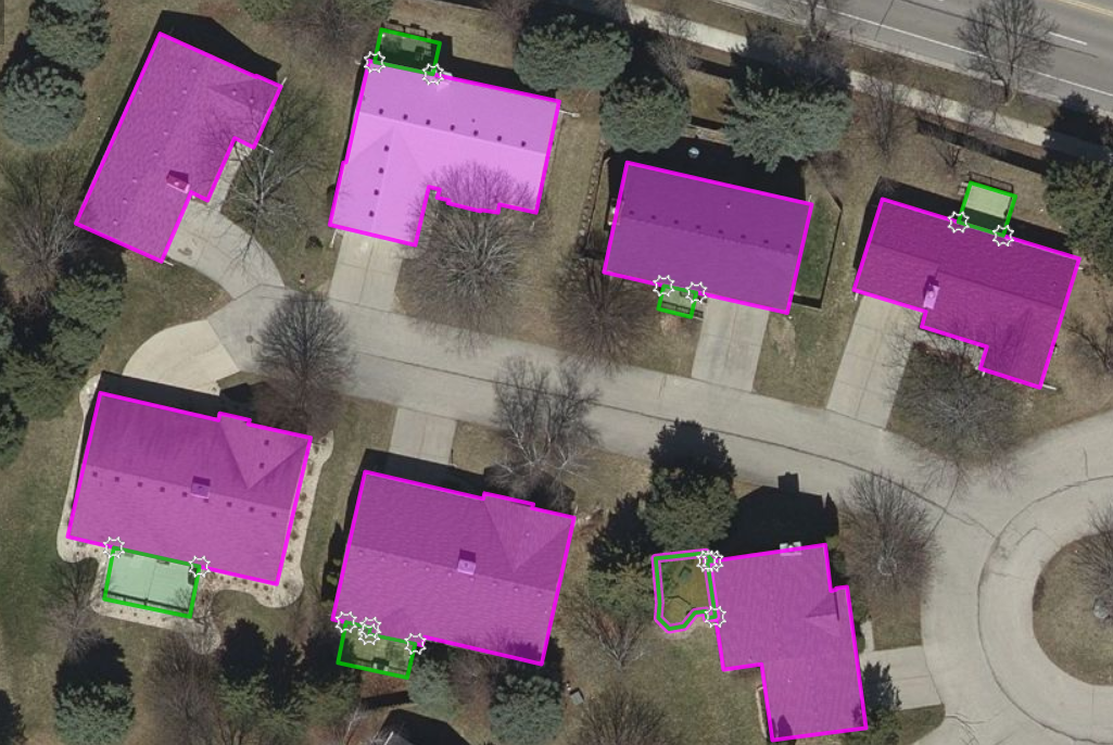
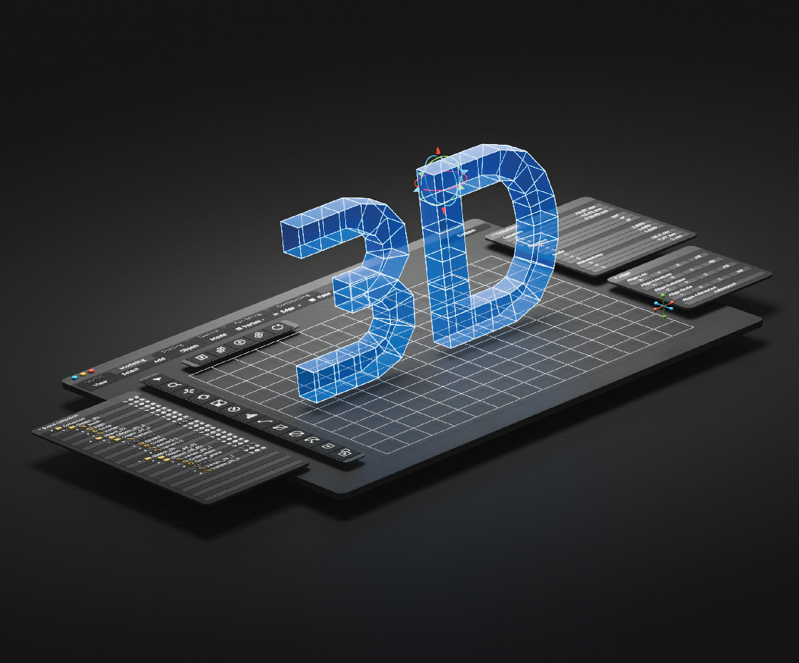
What is a Lightweight Model?

A lightweight model is a three-dimensional graphic representation of a model that resembles every other model in the viewport. However, as the lightweight models do not contain comprehensive information or metadata, they consume less memory. The light version loads more quickly, serving every aspect of the use case. 

Why is it popular?

To increase the effectiveness of BIM design, designers may design, show, compare, and alter building models using a lightweight, realistic 3D model on the same platform.

What are the benefits?

  • Extremely Lightweight – A GLB 3D file weighs 33% less than a gITF. 
  • Compatible with website & app – It works well with websites and apps without degrading their performance or loading speed. 
  • Ease of integration – The format is readily integrated with 3D product visualization, AR, and VR. 
  • Accessibility across programs – It can be opened and altered in various graphics and 3D programs.
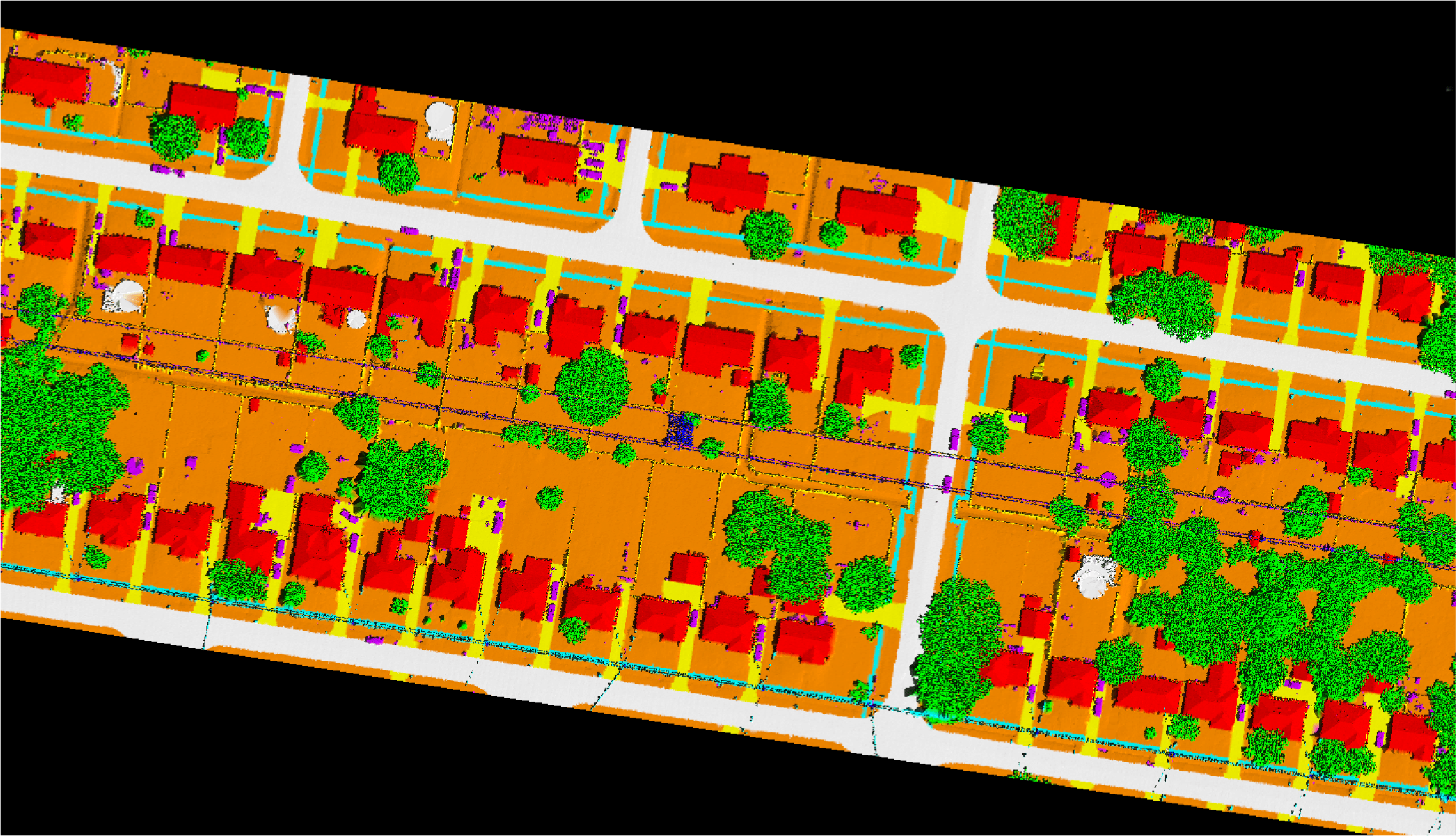
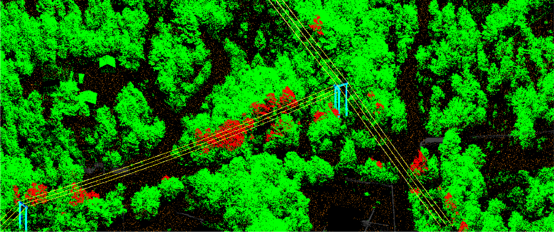
Sectors Benefited:

  • Indoor Mapping
  • Outdoor Mapping
  • Urban Mapping
  • 3D Modeling
  • Design Development
  • 3D CAD 
  • Manufacturing
  • AEC Industry

A Necessity for Simplification:

  • Engineering collaboration impacted by growing digitization and international value-added networks. Large amounts of data must be securely kept, efficiently exchanged between partners, customers, suppliers, etc., and handled with various tools according to established business and technical processes.
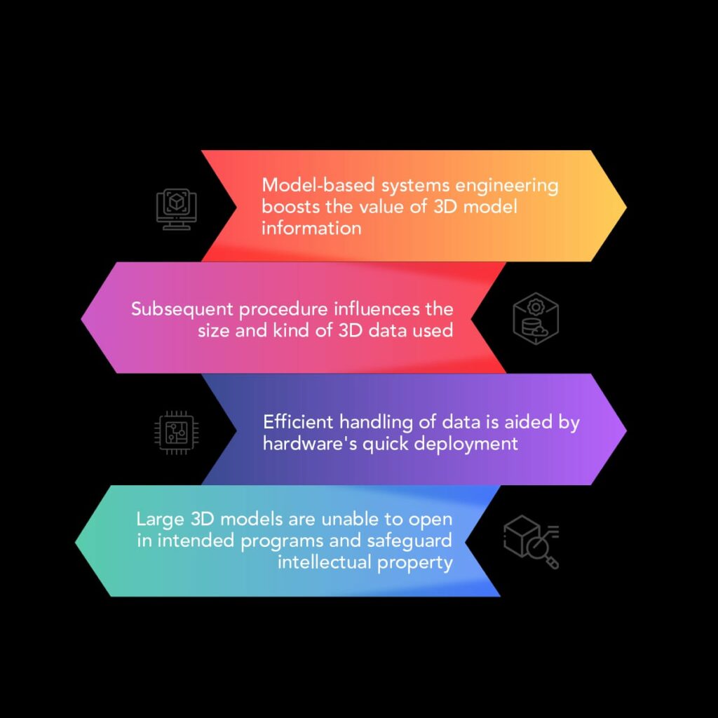
  • Approaches like model-based enterprise and model-based systems engineering even boost the value of 3D product information. As only the necessary information is handled, simplified 3D models are a crucial enabler for successful digitalization in heterogeneous system landscapes and effective reuse of CAD data in downstream processes. 
  • Further, each subsequent procedure greatly influences how much and what kind of 3D data is used. Most downstream operations only need a small portion of the data from the initial CAD model, which could result in cost savings and quicker turnaround times. 
  • The hardware’s rapid development aids efficient data handling, but 3D models develop even more quickly. Every day, a sizable number of 3D models—original CAD models and their derivatives—are created, and the amount of data in them is steadily growing. 
  • Whole-product design CAD models are typically intricate and massive in file size. Large 3D models cannot open in the intended program in the worst-case scenario. It is always important to safeguard creative intent and intellectual property when disseminating intricate 3D models outside a single organization’s confines.

Use Cases for Simplifying in Collaborative Engineering:

A valuable addition to many use cases in collaborative engineering is simplification. Simplifying 3D models can cut down on lead times, make it easier to protect intellectual property, and make it easier to use 3D models in different engineering environments. There are three prominent application cases that stand out:

1. Reduced File Size:

The primary goal of file size reduction is to produce compact 3D models of finished goods or significant assembly. Large file sizes often emerge from multiple partners utilizing different CAD systems and transferring 3D CAD data in neutral formats. The storing of redundant information in CAD models, the storage of information that isn’t necessary for the engineering activity, and the development of file sizes due to export and transfer processes are major issues.

The aforesaid reduction methods and advanced compression algorithms create 3D models with decreased file sizes. It’s utilized for fixture design, digital mock-ups, and visualization. Large products and plant engineering often use basic shapes to replace common sections.

2. IP Security:

Collaborative engineering requires IP protection, becoming more common as Industry 4.0 and the Internet of Things gain popularity (IoT). As OEMs, suppliers, value-added networks, and customers share more 3D engineering data, protecting intellectual property (IP) becomes more critical during design. When a 3D model leaves an organization, its details must be limited. Simplifying 3D models is a widespread technique. Most downstream engineering applications require a simplified representation with reference geometry.
When switching assembly models for confidential components, eliminate technical design details on the part level and wrap to remove the inner geometry. Even for simplified models, this protects design knowledge and eliminates secret information. The external surface can be as accurate as the original 3D model; approximation can alienate it.

3. Creating CAE Models:

Implementing virtual simulation and employing the CAE tool reduces production lead time and provides trustworthy findings early in the design process. Engineers can save days by preparing 3D data for CAE simulation effectively. Mesh generation based on the extracted, reduced 3D model eliminates failures or inaccurate simulation results. CAE assessments are more accurate after long iterations.

Voids or solid forms, tiny meshes, increase the number of mesh elements, leading to erroneous simulation. Suppressing these details improves mesh quality. Many clearance gaps in assembly models also require a lot of manual labor. Enveloping uses advanced Boolean operations and other cutting-edge technology to automatically find gaps and fill them in large, complex structures.

Final Thought:

For global collaborative engineering to succeed, the right amount of information must be at the right location and time. Simplified 3D models can be built automatically and used as information carriers. As a result, they are frequently employed as lightweight models in many downstream processes and are easy to explain.

Simplified 3D models promote 3D communication and interoperability in heterogeneous system landscapes that use 3D data, such as when OEMs and suppliers share data or when suppliers work together internally. They assist manufacturing companies in shortening lead times and saving on engineering. Engineers are freed from tiresome physical labor to focus on innovation. Approximation, defeaturing, and enveloping are simplification techniques that ensure reliable IP protection in data transfer across corporate borders and enable the customized development of 3D models for CAE investigations. Due to fewer details and smaller file sizes, simplified 3D models may be examined more quickly and efficiently than original CAD models.
Future studies will focus on enhancing automation to build more basic 3D models. Reduced manual effort is needed to confirm the optimal technique and repetitive simplification, especially for big and complicated plant engineering models. Best practices from multiple simplification use cases must be blended to generate the best solutions. To reach a more extensive user base faster, specialist simplification skills may be removed from tools and made available on engineering platforms. With this, collaborative engineering based on lightweight CAD data will continue to develop through 3D model simplification.

In conclusion, the use of lightweight 3D models in collaborative engineering can bring many benefits. Using our proprietary framework, we can help convert heavy 3D engineering data into lightweight files that platforms and devices can easily ingest without losing fidelity. This can help improve efficiency in many different areas of engineering, such as Indoor Mapping, Outdoor Mapping, Urban Mapping, 3D Modeling, CAD Design, Manufacturing, and the AEC industry.

 At Magnasoft, we have the expertise and the technology to provide high-quality, lightweight 3D models for various purposes. Contact us today to discuss how we can help you achieve your engineering goals.

Digital Twinning & Telecommunications: A Game Changer

Today, firms across various industries benefit greatly from digital twins. The technology enables real-time site inventory control, predictive maintenance, advanced modeling, and prototyping. The main benefit of using a digital twin is that it allows an organization to observe what is happening at every level of the process, reducing project time and expense while decreasing errors and hiccups. Digital twins are more significant than ever, especially for the telecoms industry, as the much-discussed FTTH and 5G rollouts may put more demand on already-existing network hardware, and the availability of additional spectrum bandwidth may drain already-existing infrastructure.

Current Market Scenario:
How big is the global market right now? The global digital twin market is anticipated to grow from USD 6.9 billion in 2022 to USD 73.5 billion by 2027, at a CAGR of 60.6% throughout the forecast period, according to Markets & Markets.

The rapid adoption of digital twin technology in the automotive sector is followed by the telecommunications, residential, and healthcare sectors, which are predicted to increase substantially throughout the forecast period. Digital twin technology assists telecom service providers in creating complicated network designs and upgrading current network infrastructures to accommodate new solutions such as Fiber to the Home (FTTH) and 5G. 

Digital Twinning: A Revolution in Telecom Sector:
Prior to this point, telecom infrastructure upgrades relied on a wide variety of tools and technologies for planning, design, deployment, operations, and management of networks from various vendors, most of which were used in isolated silos.  Although conventional approaches to networking administration have been successful thus far, there is a pressing need for greater intelligence and coordination between the planning, implementation, and maintenance of networks and their associated services.

The telecom business is presently seeing a revolution due to the digital twin. The global telecommunications industry is undergoing a quick digital process due to various dynamic factors, including consumer, digital, and business trends. Telecom operators worldwide are implementing digital twin technologies to monitor networks, automate workflows, enhance network performance, lower customer support calls, and cut costs. Let’s take a look at the ways in which digital twins are transforming the telecom sector.

Benefits to Telecom Sector:
Digital Twins offer numerous advantages to telecommunications operators of all sizes. These include network optimization, planning, design, and deployment efficacy throughout the operational life cycle. Telcos benefit from the saved time and resources, and the simulated results offer insights into innovative, cutting-edge business concepts. With the use of a digital twin, companies in the telecommunications industry may better understand network performance, company operations, consumer behavior, and how they are interconnected and interdependent.  It encourages telecom operators to stop allowing delays of up to several months between actual field modifications and their digital depictions.

In terms of network design, the use of this technology enables an operator to keep an accurate inventory of deployed networking assets and change management. Furthermore, Probe and Discovery-enabled Digital Twins provide proper monitoring of existing infrastructure, easing the installation of additions, upgrades, and alterations. The machine learning component of a digital twin enables an extensive what-if analysis of use patterns, network abnormalities, and failure forecasting.

3 Types of Digital Twins for Communication Service Providers:

  • Network Twin: During exceptionally high network demand, such as natural disasters, this twin can aid in forecasting breakdown points.  Since it considers weather patterns and their potential effects on the signal strength and the general health of the network, the network twin is very useful.
  • Customer Twin:  The creation of a virtual customer persona for a firm might help a telco identify specific issues that might have an impact on users. This enables the operator to tell these customers and avert any further support issues.
  • Process Twin: These twins serve as models for the majority of the essential network business operations that keep the system operating efficiently.

Role in Telecommunication Sector: Network Design and Build.

  • Field Service Administration – Troubleshooting network outages is every telecom operator’s worst nightmare. According to recent research by Gartner, businesses lost an average of $5,600 per minute due to network disruptions. Often, field service workers visit areas with only a rudimentary understanding of what they would encounter there. No matter how well-equipped they are, sites and towers are nonetheless vulnerable to malfunction, but valuable time can be saved with the usage of DT. With the benefit of additional remote support from the command center, a DT will enable the extraction of accurate information and solutions before they arrive on-site.
  • Tower Control For cell towers to operate properly, effective monitoring is essential. However, operational costs increased as a result of the complexity of growing networks, and security concerns made remote monitoring of cell towers more challenging. Using a digital twin, tower owners are able to remotely monitor and manage all of their telecom assets. Data from remote sensors might be collected on characteristics including temperature, proximity, motion, and position, assessed using AI/ML algorithms, and then integrated into the tower’s DT. By examining the tower’s digital twin, operational and management teams may be able to remedy any issues. Furthermore, it enables operators to provide this data and insights to equipment providers as a service and charge compensation for the data.
  • Network Planning and DesignTelecom companies can also benefit greatly from using DTs for capacity planning and design of their networks. Because of the need to make large changes to preexisting network configurations to accommodate the introduction of new technologies, network capacity planning and design is time-consuming for network engineers. Keeping up with configuration changes and keeping an up-to-date inventory of network components presents a constant problem for operators. On the other hand, Digital twin technology uses AI and machine learning to aggregate data from a variety of sources to build a comprehensive inventory of live network and user/device information, allowing for immediate course correction. Growth, modernization, and transformation have all been sped up by the advent of the Internet of Things. Incorporating all of these concepts into network design and planning would yield significant benefits.

The crux of the Matter:
DT technologies have made considerable strides in recent years, and telecom companies of all sizes are now using them globally. Network functions that are autonomous and software-based, like SDN and NFV, have replaced hardware-based networks. With the launch of 5G, the connection is being redefined for IoT and M2M applications and supported fiber networks, offering faster speeds, greater efficiency, and lower latency. The communications sector is being affected by disruptive waves, which are bringing both new opportunities and problems.

Magnasoft services include integrating GIS models with drone (UAV) surveys and aerial imagery, LiDAR point clouds, and the generation of 3D models in a virtual environment, all of which assist in transforming business operations and enhancing the customer’s experience of digital twin adoption. Some of the key offerings are tower structural comparison, digital tower inspections, tower structural design analysis, site acquisition, environment and design (SAED), small cell planning, as-built services.

In the future, communication service providers will benefit from using geospatially powered digital twins. We can provide our clients with one-of-a-kind services by combining our telecom, AI/ML, and geospatial engineering knowledge.

Contact us for digital twin data solutions! If you’d like to learn more about how these cutting-edge technologies can help your business remain competitive, one of our experts would be happy to contact you.

Setting up an Environmental Management System: A Must Towards Sustainability!

We at Magnasoft recognize the importance of sustainable development as part of our commitment to climate change and achieving our targets towards Net Zero. We understand that maintaining a sound balance between the environment, society, and the economy is imperative in order to fulfill the needs of the present generation without compromising the needs of future generations. Hence, we’re delighted to announce that the Environment Management System of Magnasoft has been assessed and registered as conforming to the requirements of ISO 14001:2015.

ISO 14001 is the international standard that specifies requirements for an effective environmental management system (EMS). This certification provides Magnasoft with a framework and guidelines to protect the environment and respond to changing environmental conditions in a balanced manner with socio-economic needs.

Magnasoft is dedicated to protecting the environment by preventing or mitigating adverse environmental impacts. We are highly particular about the company’s environmental policies and regulations and follow them religiously. Our policies seek to reduce CO2 emissions through advances in the recycling of resources and energy conservation. We also concentrate on controlling how our services are designed, distributed, consumed, and disposed of through the life cycle perspective, which prevents environmental impacts from being unintentionally shifted elsewhere within the life cycle. Magnasoft follows an incremental and continuous approach where we aim to take small but consistent steps every day towards achieving the long-term objective of sustainable development.

This standard helps us achieve the intended outcomes of our environmental management system, providing value for the environment, our organization, and interested parties simultaneously. The environmental policy of our business is established with the following goals in mind:

• enhancement of environmental performance;
• fulfillment of compliance obligations;
• achievement of our objectives on climate change and Net Zero

Commenting on the new certification announcement, Suman Dasgupta – Vice President – Sales & Business Development, Europe said: “At Magnasoft, we are committed to achieving our objectives on sustainable development, climate change, and Net Zero targets by incremental and continuous improvement of our processes and empowering our employees and all stakeholders working together to achieve this. ISO 14001:2015 sets the direction and facilitates this. “

In essence, our ISO certifications show that we have solid, precisely laid-out procedures across all our business divisions.

For more information, please get in touch with info@magnasoft.com. Follow us on LinkedIn for recent updates about Magnasoft and our solutions and services.

We’re Cyber Essentials-certified

At Magnasoft Europe Limited (MEL), we understand the significance of enhancing security. We consider this to be fundamental to all aspects of our business. We are therefore pleased to announce that we are now a Cyber Essentials-certified company. The accreditation, developed by the United Kingdom government’s National Cyber Security Centre, is awarded to enterprises that can demonstrate solid cyber-security principles and capabilities that ensure a high level of security, cyber resilience, and assurance of defense against online threats. It protects the confidentiality, integrity, and availability of data stored on internet-connected devices like PCs, tablets, smartphones, and server and networking equipment.

This accomplishment bolsters Magnasoft’s commitment to strong corporate governance principles and efficient IT security. It also shows that the company’s policies and procedures are strong enough to protect it from cyber threats. Our company is dedicated to adopting cutting-edge, mutually beneficial cyber security measures. The company would also have a precise and comprehensive image of its cyber security level for future reference. The certification demonstrates the implementation and efficacy of the security controls in place to secure Magnasoft customers’ data. The evaluation assessed:

  • Boundary firewalls

  • Secure asset configuration

  • Patch management

  • User access controls

  • Malware protection

  • Mobile assets

Commenting on the announcement, Tanzeem Yousuf Khan, DGM-IT, Magnasoft, said

Cyber Essentials helps to guard organizations against cyber-attack and ensure adherence to the UK statutory requirements. Magnasoft complies with security standards by adopting best practices like ISO 27001 and GDPR; with Cyber Essentials certification, we have a new addition to our Information Security Management System. This will reassure customers that we are working to secure our IT against cyber-attack, attract new business with the promise of having cyber security measures in place, have a clear picture of our organization’s cyber security level, and also enable us to expand business on government contracts requiring Cyber Essentials certification.

For more information, please contact info@magnasoft.com. Follow us on LinkedIn for recent updates about Magnasoft and our products and services.

BIM: A revolution in AEC Industry

Building Information Modeling (BIM) is one of the fastest-growing concepts in the Architecture, Engineering, and Construction (AEC) industry. It facilitates multidisciplinary information sharing between project parties, improves efficiency, and increases productivity. Pacing parallel to the infrastructure world and rooting itself in impactful technological innovations, Magnasoft brings two decades of expertise in the Geospatial industry and a growth mindset to provide the foundation for immersive experiences and operational excellence.

One advantage BIM offers is syncing the designer’s and user’s perceptions and understanding by overlapping the grids of imagination and reality. Building Information Modeling (BIM) is a cutting-edge 3D rendering tool that is the foundation of the AEC industry’s digital transformation. It seamlessly weaves the multi-disciplinary digital representations created during design, construction, and operations, improving the industry’s real-time coordination and collaboration. BIM is implemented in four stages to simplify the complexities –

  1. Evaluation / assessment
  2. Preparation for the transition / project pre-planning
  3. Execution of plan / design & construction
  4. Operations & maintenance through experience & expertise

While traditional workflows are prone to errors and back-and-forth coordination causes delays, BIM has elevated monitoring solutions with sequential animation of construction layers, resulting in better planning and execution while optimising financial inputs and time. With 360-degree organised control over the project, the benefits come in a domino effect with BIM and 3D visualisation. Here are a few to begin with –

EFFORTLESS COMMUNICATION
With realistic 3D visualization and comprehensive recreation of the context, virtual tours and walk-throughs have aided dreams in getting built; they have given life to nothing less than spectacular results and experiences! Globally, project approval rates have increased as a result of this.

STREAMLINED COORDINATION

For the interlinked web of the co-dependent industry that exists as a system to execute a project, BIM steps in like a blessing! It smoothens the communication, design process, and execution for all the stakeholders aligning their responsibility and time for their contribution to the project.

OPTIMIZING RESOURCES
With integrated real-world building materials and detailed drawing representations in BIM, the schematic structure can be visualized, analyzed, and reviewed concerning the use of materials, resources, and energy effectively. This enables stakeholders to make more informed and timely decisions and avoid on-the-ground clashes and revisions.

CLASH DETECTION & RESOLUTION
BIM allows for the effective identification, inspection, and reporting of interference clashes at the 3D model stage, which aids in the reduction of design errors and inadequacies that may cause delays and budget issues during construction. In addition to enabling construction sequencing, material, and equipment lead times that comply with the original design intent, it also contains the components’ final estimated locations.

When combined with Virtual Reality (VR) and Augmented Reality (AR), BIM has eliminated doubts and increased its viability and use in the AEC sector. With this ground-breaking adaption, the possibilities for incredible experiences and real-time projects are endless. Are you curious about the future of BIM? With even higher technology aligned with the current scenario, the big picture advances significantly and should attract extraordinary results in future construction projects.

The Role of 3D Mapping in Sustainable Urban Development and Renewable Energy

Around 70% of the world’s population will live in towns and cities by 2050. This would indeed place an increasing pressure on land to support development. Reports suggest that buildings consume one-third of the world’s total energy. It accounts for over 38% of all energy-related carbon dioxide emissions. Enhancing the energy efficiency of buildings, both new and existing, has become a global priority today to minimize environmental impact and provide long-term sustainability. But how does 3D mapping promote sustainable urban development and renewable energy? Let’s see.

The Potential Solution 

Geospatial technology and data have become ubiquitous in this digital era for project management. The solution is to leverage the benefits of geospatial technologies to promote sustainable urban development. The convergence of 3D BIM, geospatial, and energy modeling is enabling designers to reduce the carbon and energy footprints of existing and new structures. Our technology has evolved tremendously, and by using the right data we can build highly- energy-efficient structures.

A BIM (Building Information Modeling) approach to modeling could be a potential solution for the impending problems we face with buildings and energy efficiency. Environmental analysis and several other certification programs like BREEAM and LEED require natural lightning, solar radiation, wind, renewable energy, and noise analysis, all of which require the integration of geospatial information. This data, along with local climatic conditions with the building design information is gathered, stored, and used in BIM.

Moreover, by bringing unmatched detailings in instructions, 3D Modeling allows businesses to make collision-free plans of the infrastructure. For instance, in the case of solar panel installation, a 3D mapping not merely shows how it looks but also maps the movement of shadows over the site during a day. This offers designers an accurate perspective to create an optimal design, making the most efficient use of the space. The accurate prediction of the solar energy generated using the rooftops of buildings is a paramount tool for several researchers, decision-makers, and investors for creating sustainable cities and societies.

Mapping the Solar Potential of Rooftops, one rooftop at a time

The Significance Of 3D Mapping And Geospatial Data

Thanks to new and faster mapping techniques, sustainably addressing rapid urbanization has never been so seamless and accurate. With detailed 3D mapping, engineers and builders are completely aware of the environment they would be dealing with. With 3D terrain models, the depiction of terrains, elevation, and slopes become factual. 

Precisely, geospatial data is inevitable in implementing a sustainable infrastructure of roads, water, waste, and power. Offering a single source of accurate, environmental information fuels up the process of decision-making for governments, authorities, or policymakers. 

The significance of 3D geospatial data is not limited to a better understanding of the infrastructure models but is also used as an input by engineers in complex construction works. The maps are keenly based on accurate measurements and scaled as per project requirements. This offers industry professionals a realistic view of a site, to accurately manage a project’s feasibility, costs, and scheduling.


Smart city projects that are emerging worldwide are examples that we are going on the right path to sustainable urban development. The significance of 3D mapping and geospatial data for creating these smart cities is just paramount. Using real-world visualizations for conducting analysis and design improvements of infrastructure helps companies focus on excellent development and usage of land in sustainable ways.

3D GIS for Environmental Planning for Sustainable Urban Development

How Geospatial Data Supports Energy Management  

How to get a bigger picture of the performance of a building at its location in its expected climate? 

An analysis of the geographic location and orientation of the building, collected by 3D mapping along with the local historical insolation and weather information including temperature, moisture, wind, and psychrometric data would generate this information. This is crucial in creating a working hypothesis about a building’s energy behavior. It also helps in finding the right gaps opened with an opportunity for energy savings, including water infrastructure, daylighting and lighting efficiency, renewable energy generation, waste, and efficiency.

The energy analysis leverages the geographical location of the building with the local environmental conditions and performs thermal, lighting, and airflow simulations. This helps in estimating the amount of energy a building will consume in a year and further tests design options to identify the best possible solutions to conclude energy use, CO2 emissions, occupant comfort, light levels, airflow, and LEED certification level. 

Studies have proven that energy analyses and testing alternative options allow projects to reduce annual energy consumption and power bills by 40%, certainly a stepping stone for sustainable urban development.

The Role Of 3D Modeling In Promoting Sustainable Urban Development

A building is always integrated with other infrastructure such as the transport system, utilities, environment surrounding, etc. Curating data that integrates all this has become a necessity today. This is where 3D mapping comes into the picture, a machine vision technology that can profile objects in 3D to map them in real-world scenarios. The information contained within a detailed 3D model facilitates builders with the accurate data to coordinate utilities, grading, and system routing information accurately. 

The significance of urban planning in creating sustainable environmental practices is inevitable and geospatial technologies will have a huge impact on sustainable urban development. The data captured using industry-standard acquisition methods and techniques is processed into meaningful 3D models with details on attributes, measurements, and location using 3D city modeling software. In the backdrop of global warming, understanding the importance of optimizing energy efficiency is essential. 
Companies like Magnasoft have been offering high-dimensional 3D mapping services to help engineers in visualizing all the elements of a project, especially renewable energy sites. Our urban mapping solutions have helped government bodies to focus on development, especially in lands with limited spaces. We have delivered 3D modeling projects covering around 80% of cities globally, capturing data using 3D Mobile LiDAR & UAV (unmanned aerial vehicle) or drone for creating base maps.

Urban Vegetation Mapping can be the basis of Green Infrastructure Planning

Changing The Energy Landscape Using 3D Mapping

With the renewed focus on climate change, renewable start-ups have expanded their focus beyond clean energy to energy independence. The ability to maximize the utilization of geospatial technologies is the fuel that powers this energy independence. It plays a key role in supporting the development and expansion of wind, solar, and hydro energy. 

By monitoring the process, ensuring that renewable energy generation sites are optimally sited, and affirming that the power generated is delivered efficiently, geospatial data offers a clear insight into the gaps where energy can be saved and sustained. 

For instance, wind turbines should be located in places with consistent wind resource availability and variability. This includes understanding the air volume, velocity, and density. Using the best topographic information and precision mapping, one can seamlessly locate wind turbines in highly desirable sites. 

Jason S. Rodriguez, CEO, and Director of Research of Zpryme, a research and consulting firm, quoted that, “the growth of the renewable energy space is going to open doors for Smart Grid vendors and manufacturers who can provide niche systems, software, and equipment that can integrate renewable energy sources in the Intelligent Utility ecosystem.”

Cities and industries across the globe are realizing the significance of geospatial insights and are working towards reducing carbon footprints by leveraging the best out of it. Masdar in the UAE is working on an ambitious plan to build a Masdar City, located 30 kilometers from Abu Dhabi city. Committed to meeting the goals of zero waste, sustainable living, and carbon neutrality, the company is extensively using the Geographic Information System (GIS) to design this future city.

A Final Word

Numerous renewable energy options are available today, but the performance of these various options depends on location-based variables, implying the necessity for geospatial analysis. Geospatial technology is proving to be an essential component of the decision-making process in every project. It enables designers to significantly reduce the energy footprint of existing structures, including historic buildings and new designs. 

It’s high time that we realize that the “Geospatial way” is certainly the future, and the most efficient way to collect, process, and utilize information to promote sustainable urban development on a global scale. Well, one cannot deny Jack Dangermond when he said, “GIS is waking up the world to the power of geography, this science of integration, and has the framework for creating a better future.”

Interested to know more about Magnasoft’s location and 3D mapping services. Click here and connect with us now.

How to make automated driving safe?

The localization of HD maps for self-driving cars is another significant challenge that is restricting the industry to realize the AV dream.

Challenges in HD Mapping

Gartner forecasts that by 2023, over 740,000 autonomous vehicles will make a presence in the market. However, for the AVs to be quickly and effectively deployed on the roads, some challenges need to be conquered first.

Petabytes of Data

Autonomous vehicles collect data from a variety of sources such as cameras and sensors, including imagery, LiDAR, radar, GPS. This raw data must be annotated and labeled for making autonomous vehicles self-reliant. It is quite a challenging task to process the petabytes of data collected from such a wide variety of sources effectively. Traditional architectures of automotive frameworks are not found suitable for the large-scale data processing workloads required for testing the algorithms used in the testing of autonomous vehicles. This massive amount of data must be analyzed intelligently so as to enable autonomous vehicles to make decisions faster in diverse conditions. This is necessary for achieving efficient HD mapping solutions, which are necessary for making safe driving through AVs a reality.

Localization of Maps

Additionally, for safe navigation, it is necessary to associate the static map data with detected dynamic information. This is called localization of maps which is an essential component of autonomous driving.

Maps represent the static world, however, some parts of the world keep on changing frequently. HD maps need to be updated accordingly so that the automated vehicles are able to drive safely by relying only on correct information about the roads. Updated HD maps help the AVs to locate and identify lane markings, static and moving objects, pedestrians, traffic lights, signages, etc., thereby helping them to make sense of their surroundings and drive safely.

Scaling up with the Right Partner 

Autonomous vehicles are still working towards reaching the stage of full autonomy. There are a lot of issues to be ironed out; safety being the foremost. To be able to effectively detect, track and classify objects and make informed decisions for path planning and safe navigation, the autonomous industry needs to establish the right partnerships. 

The industry needs to work with experts in the field of HD Mapping Solutions, Data Annotation, 3D Modelling, 3D Image Capture, etc. with a strong portfolio of global projects to make the dream a reality. 

Extensive mapping and 3D modeling experience along with a solid leadership team make us qualified to be such an expert.  Our team possesses the experience and expertise to create market-leading HD maps for autonomous driving that can significantly enhance sensor perception, enable precise localization, and improve path planning for AVs. Our analysts specialize in analyzing the sensory data collected by autonomous vehicles from disparate sources. 

AI systems can aid in cleaning up the data collected by autonomous vehicles. But the precision level achieved by these systems is about 70%-80%. For achieving 100% precision in the data, human expertise is indispensable. This is where our strength lies. We are well-equipped to provide you with expert HD mapping services.

Along with expertise in mapping, our extensive experience in 3D modeling provides us an added advantage of understanding the driving environment intricately. Breaking the silos, we are also partnering with leading mapmakers and leaders in providing large-scale and systematic visualization of physical environments; all this to enable the autonomous vehicles industry to achieve its goals, most effectively and quickly.

Conclusion

To win the autonomous vehicles race, automakers have to move from developing autonomy to developing an intelligent autonomy. Automakers who will be able to accelerate this process will gain a winning edge. 

Be it enabling the AVs to locate objects and boundaries like people, cars, flowers, furniture, or human faces or to safely navigate using highly accurate HD maps for self-driving cars, our experts are ready to smoothen the journey for the industry. As we work towards creating unique ‘glocal’ maps for autonomous vehicles, we look forward to exploring the various opportunities in HD mapping and collaborating and evolving together.

Also Read: Spatial Intelligence is at the Centre Stage

BIM in Infrastructure Projects: For Unmatched Outcomes

BIM allows more intelligent use of resources, optimization of workflows and leads to higher productivity and profitability in infrastructure projects. It is an intelligent 3D model-based process that provides architecture, engineering, and construction (AEC) professionals the insight and tools to more effectively plan, design, construct, and manage infrastructure projects. Implementation of BIM leads to better outcomes in these projects since communication and collaboration becomes more effective.

Why Adopt BIM?

BIM makes available both the visual and the non-visual information related to every aspect of the infrastructure project to the designers, engineers, builders, manufacturers and owners involved in the project. This information, which is available in the form of highly precise 3D models, allows them to gain an in-depth understanding of the building much before it is actually constructed. Accordingly, the errors in design are quickly identified and corrected before any major investment is made in the construction work. 

Moreover, we are aware that in any infrastructure project, several teams work together. While one team looks after planning, another takes care of designing, yet another carries out the construction, and another one takes care of the maintenance activities. Timely and seamless communication among these teams is crucial to not only avoid losses and repetitive work, but also to achieve optimum efficiency in workflow management and resource utilization. BIM aids in achieving this communication magnificence in the projects.

What’s more? A building in a city is always integrated with other infrastructure such as the transport system, utilities, etc. The information contained within a 3D model enables builders to coordinate utilities, grading, and system routing information accurately. With BIM, designers are able to create more accurate designs which ensure the project functions properly and lasts for decades. 

Your Partner in Effective BIM Coordination 

For over two decades, Magnasoft has been helping residential, commercial and industrial infrastructure projects to build sound BIM coordination ecosystems based on parametric Revit families and Navisworks with material specifications. From healthcare facilities to airports to resorts, we have been helping diverse industries to have precise 3D coordination models that help them to identify design errors and come up with alternative design solutions in a timely manner. 

Efficiently combining Architectural, Structural, and MEPF models to finally deliver a highly accurate 3D model of the building along with the design codes and the building standards is what our expert BIM team specializes in. We can match the industry requirements with current trends to provide accurate deliverables that make us a leading BIM coordination services company at global level. Additionally, our Clash Detection Services enables the project stakeholders to detect any complicated, soft, or workflow clash early, thus bringing huge savings in terms of cost, time, and resources.

Scan to BIM

In case of infrastructure projects, the Scan-to-BIM method of design is a widely popular one since it helps professionals to capture detailed information right at the beginning of the project. Scanning can be done at various other points during the project lifecycle to better document milestones. It can also help in documenting errors and identifying solutions faster. The data captured through laser scanning helps in creating a permanent ‘as-built’ record of the project. This data significantly helps in managing the building operations and renovations in the future. 

Using our extensive knowledge in laser scanning and 3D BIM modeling, we have been aiding the AEC industry to achieve the highest level of accuracy and detail in their construction projects. Over the last 20 years, we have executed Point Cloud to BIM Modeling projects for various building types. Our expert team converts point cloud data into information-rich BIM models which enable the stakeholders to make informed decisions quickly. 

BIM and Large Infrastructure Projects

In case of large construction projects such as airports, transit systems, bridges, and tunnels, it becomes especially a huge challenge to track the progress of each activity. While traditional methods of tracking include generation of a wide range of reports, which are susceptible to errors. BIM can provide sequential animation of all activities. Needless to say, this method of presentation offers a better understanding of the progress. The visual comparison of what was planned against what is done on-site brings in more efficacies in the final outcomes.

Along with infusing more collaboration among team members, BIM with real-time AI plays an instrumental role in reducing on-site risks and injuries. Moreover, since all construction site activities are recorded digitally, the risk of a data breach or misplaced paperwork is removed.

The importance of BIM in large infrastructure projects can be better understood with the help of an example. For instance, using highly accurate 3D models, as provided by experts like Magnasoft, smart airports are able to achieve unmatched performance in airfield inspections, pavement management, terminal work orders, runway signage and more. Geospatial technologies help airports significantly in controlling costs and optimizing asset performance. This better management of assets eventually leads to better preservation and prolonged life cycle of the most valuable assets. For maximizing revenue generation, airports need to ensure that the space available is used optimally. They need to ensure optimum management of their terminal and landside real estate, while providing enhanced customer experience. GIS and allied technologies help the airports to get more from their infrastructure. 

Conclusion

BIM is metamorphosing the construction industry. Companies across the globe are using the technology to get optimum outcomes from their construction projects. With urbanization gaining new meaning every day and everywhere and smart cities gaining momentum, countries around the world are paying more attention to the adoption of BIM and 3D modeling in construction. After all, how long can they ignore the benefits. Adoption of BIM makes a country rich on the infrastructure side, making it become an example for others to follow.

Magnasoft’s in-depth understanding of BIM and 3D modeling techniques coupled with vast experience in the fields makes it a preferred partner for medium to large infrastructure projects across the globe. A cross-trained, flexible workforce and a dedicated QA & QC team ensure superior output quality at all times.

So, as you take the next step towards digital transformation, let us help you overcome the challenges and achieve exemplary results in the projects.

Bridge the Resource Gap for your Fiber Design & Permitting Projects

The global demand for high-speed, broadband internet is rising rapidly with enhanced use of data all over the world. In this scenario, as copper wires are no longer able to support the desired level of connectivity, the answer lies in fiber optic networks. 

Consequently, fiber optic networks are becoming an attractive domain for financial investment. 

To have high revenues from the venture, along with the cost of fiber, network operators need to evaluate potential opportunities with market-specific insights. Along with assessing how the network development efforts will get affected by environmental factors and competition, resource mapping remains a crucial focus area. 

Fiber Optic Network Design

The process of launching a new fiber network involves several phases and detailed attention must be given to each phase for a flawless design. In the design process, crucial decisions with respect to the network’s topology, communication system, equipment needs, and list of services need to be taken. The efficiency with which these decisions are taken eventually determines the success or failure of the network. Whether the network meets the needs of the end users depends on the efficacy of these network design decisions.  Needless to say, you cannot afford to make any compromises in the level of expertise used while making these decisions.

As a network operator, you must also be prepared for possible future issues, obtain the required permits, and document every important detail about network components and cable routes. To have the best results in fiber designing, you must deploy an expert team of designers, who possess in-depth knowledge of fiber optic technology, installation processes, and regulatory standards.

While the necessity to have an expert team to carry out the entire network design process efficiently cannot be denied, the availability of such experts in this growing market remains an area of concern for the industry.

Mitigating Resource Gaps

Fiber optic designing is a highly technical process and any snag anywhere can lead to fiber optic malfunctions such as broken fibers due to physical stress or excessive bending, inadequate transmitting power, excessive signal loss due to an exceptionally long cable, faulty splices or connectors, etc.

The installation as well as the troubleshooting process for fiber is very different from that of copper wires. What’s more? There are more potential causes of trouble as the fiber optic cable is far more fragile than copper cable. Thus, the need for skilled workforce to carry out the fiber optic design process cannot be stressed enough.

This is where Magnasoft can empower you to meet the deadlines, beat margin targets and deliver uncompromised quality. We achieve this by bringing highly qualified teams with extensive experience to your underground and aerial fiber design projects. For underground projects, we leverage our expertise in spatial data processing, GIS and CAD to help you develop land base maps, draft fiber networks, create construction notes and much more. For aerial projects, we’ve partnered with companies like Katapult, SPIDA Software and Osmose to provide a complete back-office solution that enables engineering companies to upload their field data to the cloud where we perform QA/QC, produce accurate pole annotations, pole load analysis, make-ready recommendations and permit applications. We can deliver 80% of the information that your engineers need to complete their projects on time and within budget.

Rights of Way

No discussion on fiber optics network can be complete without paying attention to Rights of Way (RoW). For laying fiber-optic cables over privately owned property or through parks, waterways, and other public spaces, parties need Rights-of-Way permits. The RoW is a critical element in the telecom space because it gives the telecom companies guidelines on how to lay the infrastructure elements (towers, optical fiber cables, etc.) on a specific route. 

The process of getting a permit involves filling out an application form along with the details of the fiber-network route. The permit request is accompanied by aerial imagery and CAD drawings of the proposed network design. We can help you create detailed site drawings, permit detail drawings, and presentation quality overview maps. We are committed to make the permit application process simpler and successful for you. 

Magnasoft Communications Solutions for You

Magnasoft has been serving the telecommunications industry for the last 20+ years. Accordingly, it has been able to build a repository of industry specialists and focused resources, which can provide you unmatched support in your fiber optic network project. Having handled many large-scale projects, we have been able to develop a network of resources in all engineering areas from which we can call upon as per your needs. Our teams are capable of handling the most advanced technology solutions such as AutoCAD, Micro Station, SPIDAcalc, O-Calc Pro, PoleForeman and PLS.

Whether you are looking at engineering needs for a new plant or plant extensions or upgrade of existing networks, our Communications solutions can help you achieve excellence in the project. Our expert team can assist you in developing long-range OSP plans, including dispersion of fiber pairs and technologies along the route, fiber facilities management, fiber optic network planning, etc. 

We can also help you in RoW acquisition, make-ready recommendations and pole attachment applications. For underground facilities, you can rely on our experts for preparing conduit design, conduit detailing, manhole detailing, preparing all forms and documentation for approval and verify as-built. 

Quality is of utmost importance to us. To ensure the highest standards in our deliverables, we continuously review our processes during a project’s lifecycle. This constant monitoring and implementation of feedback and suggestions from clients also leads to quicker and excellent outcomes. 

Conclusion

According to the Fiber Broadband Association, implementation of 5G in the top 25 urban areas of US will involve deployment of about 1.4 million miles of fiber. As you get ready to play a critical role in this growth story, let us be your preferred partner in overcoming the challenges related to availability of the right resources to meet your deadlines, beat margin targets and deliver uncompromised quality.

Is high-fidelity spatial data the answer to FTTx challenges?

The demand for bandwidth is on a constant rise and communication service providers (CSPs) are working incessantly to meet the rising demands. With the growing importance of digital services, CSPs are continuously innovating to create a balance between quality and expenditures. Accordingly, network infrastructure is undergoing rapid development as well. In a scenario where last-mile connectivity is becoming a necessity, network designs need to be honed. 

Enters FTTx

FTTx or fiber to the “x”, a collective term used to describe a diverse range of broadband network architecture options is the talk of the town today. FTTx architectures use optical fiber for some or all of their last mile connectivity accomplishments. The promise of the dual advantage of higher transmission rates and lower energy consumption makes FTTx a highly desirable choice for the industry. The “x” in FTTx, which stands for the fiber termination point, such as home, antenna, building, etc. makes the network move closer to the user, promising better user experience. 

Data is crucial

Data lies at the heart of all the developments. The CSPs can deliver the expected outcomes only when the project begins with the right data.  The task of building a new fiber network is an incredibly complex task and if the process begins with out of date or inaccurate data, not only will the challenges increase manifold but the final deliveries will also be of no use. As geospatial experts say, “Garbage in, Garbage out.” High-fidelity spatial data is an important component of the entire scaling-up process.

Thus, before planning a rollout, it is mandatory for CSPs to gather and analyze a broad base of project relevant geospatial data. They must have adequate knowledge of their current asset inventory i.e., the type, location, and condition of their current network assets. This data can aid the CSP to not only come up with a true inventory of the organization’s assets but also identify the potential obstacles to the project’s success. Accurate spatial data can also help the CSPs to have a clear knowledge of the features/parameters that they can leverage to their advantage. 

NextGen Network Management with Geospatial

It is estimated by the Fiber Broadband Association that just in the top 25 urban areas of US, 5G will involve deployment of about 1.4 million miles of fiber. Needless to say, CSPs can effectively capitalize on this demand, only if they are able to deploy or expand their networks quickly and efficiently. Asset documentation and management is a major challenge.

A robust ‘geospatially’ powered solution can help the players overcome the bottlenecks. Such a solution can help them in going to market faster by accurately outlining the current connections, mapping the existing infrastructure, and providing a clear view of the available network capacity, thereby helping in identifying the best routes for expansion. 

Additionally, the remote visibility will bring in efficiency in operations and costs by reducing the need for expensive field maintenance tasks. Dynamic reports, based on crucial spatial insights will enable CSPs to accurately evaluate the network and take informed decisions related to acquisitions and sale. 

Conclusion

Since long, GIS is being used by the telecom leaders to achieve efficiency in network design and planning; to prioritize the areas that need maximum improvements, conceptualize a network layout plan, and develop strategies on meeting the capacity requirements optimally.

Using cloud GIS, companies have been storing all planning, engineering, and management data at one place. By combining aerial and underground imagery and adding geo-located asset data, telecom companies have been quickly creating layered, data-rich maps. This type of clear documentation have reduced possibilities of errors and also streamlined communication among the teams.

It is now time to take the capabilities of geospatial to new levels and help the telecom industry achieve new milestones as the world gets ready to embrace advanced technologies like 5G. 

To meet the growing need of better last-mile connectivity, it is vital for the telecom giants to ensure that high-performance networks are built right from the design phase itself. A robust network is fundamental to providing all the promised services. The answer lies in a geospatial-based inventory

Spatial insights can help the stakeholders to have the most effective outcomes in designing, building and operating the network. The role of an experienced ‘design, build, operate and maintain’ partner is crucial in the entire lifecycle; right from network deployment to maintenance. Magnasoft is highly experienced to function as such a partner. 

With numerous successful projects in our repertoire, our expert tem is skilled to effectively address the needs of the communications industry. The Communication Network Services suite offered by us focuses on enabling digital transformation of CSPs and industry leaders. Using our fully integrated and interoperable solution, you can achieve excellence in FTTx network activation, service installation, performance optimization and much more. We understand how crucial geospatial is for a successful 5G rollout and strive to provide robust solutions that make this possibility a reality.

Also Read: Importance of Vegetation Management for Power Lines

Icon Contact Us
IconTalk to Us