The power utilities industry is expected to lead this transition. To understand better which technologies, tools and practices will aid the industry to accelerate, we engaged into an interaction with Mike McGill, an expert in the utility segment.
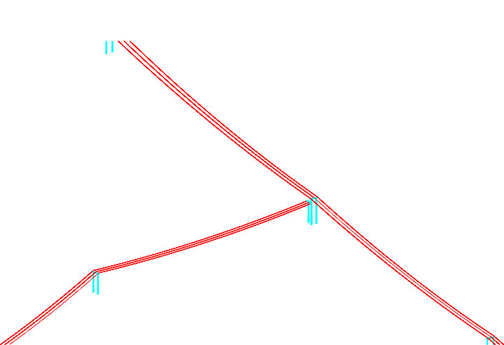
Industry trends such as risk management and an evolving workforce are incentivizing electric utilities to establish and maintain better information about their assets. We live in a 3D world and therefore the people who are developing better asset databases have a natural proclivity towards representing this information in 3D.
In short, 3D mapping and asset information is more relatable to the people who need it and therefore drives certain inherent efficiencies. For example, one of the greatest contributors to cost and risk is the deployment of field crews. Traditional 2D mapping and asset information contributed to reducing field visits, but not to an optimal extent. It is natural for people to want to see data in a way that represents the real world. The more we can present information in three dimensions or better yet as a digital twin, the more people will trust it and use it and in pursuit of mitigating risk, deriving better answers and introducing new efficiencies to asset management.
A major change that I have witnessed is an increase in the use of structural analysis applications like PoleForeman, OCalc Pro and SPIDACalc in the design process. Historically, distribution teams have not had the luxury of budgeting the use of applications like PLS for the placement of utility poles. High profile incidents such as fires in the west and hurricanes in the east have introduced significant cost and personal pain due to outages and loss of life. While structural analysis has always been used in distribution, it tended to lean in the direction of slide rules, spreadsheets and overbuilds. In today’s world of increased liability, it’s important that a utility associates design decisions to a model. These applications are making it easier to model recommendations prior to construction and therefore adoption of these applications is growing.
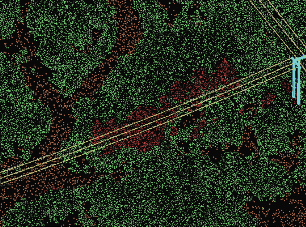
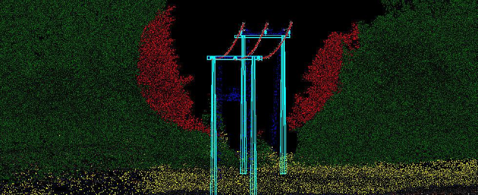
Vegetation monitoring and analysis solutions are clearly advancing as measured by multiple companies offering solutions that improve traditional vegetation management processes. I see three drivers contributing to this advancement, data proliferation, cloud-based parallel processing and Artificial Intelligence / Machine Learning (AI/ML). Between LiDAR, Optical and other sensors operating from space, aircraft (including drones), cars and people, we do not suffer from a lack of data. The proliferation of data is creating a mandate for processing and conversion of data to answers. This mandate is bringing AI/ML into the mainstream and the availability of massive parallel computer processing on demand is broadening access to this capability.
Magnasoft is in a great position to support and advance these drivers because of its lineage in data processing and continual pursuit of balancing the application of people and technology in the conversion of data to produce answers for our customers. Specifically, AI and Machine Learning algorithms require consistent and accurate data applied to training workflows that enable humans to train the algorithms. Magnasoft has been producing consistently accurate data for more than 20 years. This includes ongoing development of workflows that are necessary for development of AI / ML libraries that help us automate the production of maps that tell our customers where and when to trim or remove vegetation.

From my vantage point, the biggest barrier to the future of 5G is the time and cost associated with design and permitting. One of the prominent companies in the US recently reported that it’s taking them up to 36 months to integrate and bring new 5G radios online. LiDAR and related field data collection technologies have the potential to help alleviate this bottleneck by reducing field data collection time while producing consistently accurate data.
Unfortunately, the time saved in the field is equating to more time needed in the back office. More time is getting consumed in processing the data and producing the models needed for structural integrity and visualization to ensure that the aesthetics of the equipment align with community guidelines. Magnasoft’s extensive experience in creating consistently accurate 3D models and automating permit production will definitely contribute to alleviating a significant part of the bottleneck.
I see two interesting developments. First, the utility industry began to invest in GIS approximately 25 years ago and it appears that it’s time for those systems to be overhauled in exchange for the next generation of GIS which promises to be less siloed and more integrated with other enterprise systems. The big winner is ESRI at the expense of GE, Schneider Electric and others. This is a great trend for Magnasoft because new systems tend to raise the bar on quality of mapping data and expose discrepancies in the maps and related data that has served legacy systems. On a somewhat related note, the ongoing push for geospatial solutions is elevating the discussion and need for vegetation monitoring to support traditional vegetation management programs. Vegetation monitoring is inherently geospatial as it requires accurate base maps, network diagrams and a continual flow of remotely sensed information to determine the work that needs to be done and validate jobs that have been completed.
While COVID 19 has had a negative impact on many industries, it has possibly accelerated the demand for more bandwidth. COVID 19’s impact on traditional businesses is creating an economic stimulus response that will include hundreds of billions of dollars for improving roads, bridges and our electric grid. All these activities require accurate maps and 3D models for design and permitting, wherein experts like Magnasoft will have a major role to play.