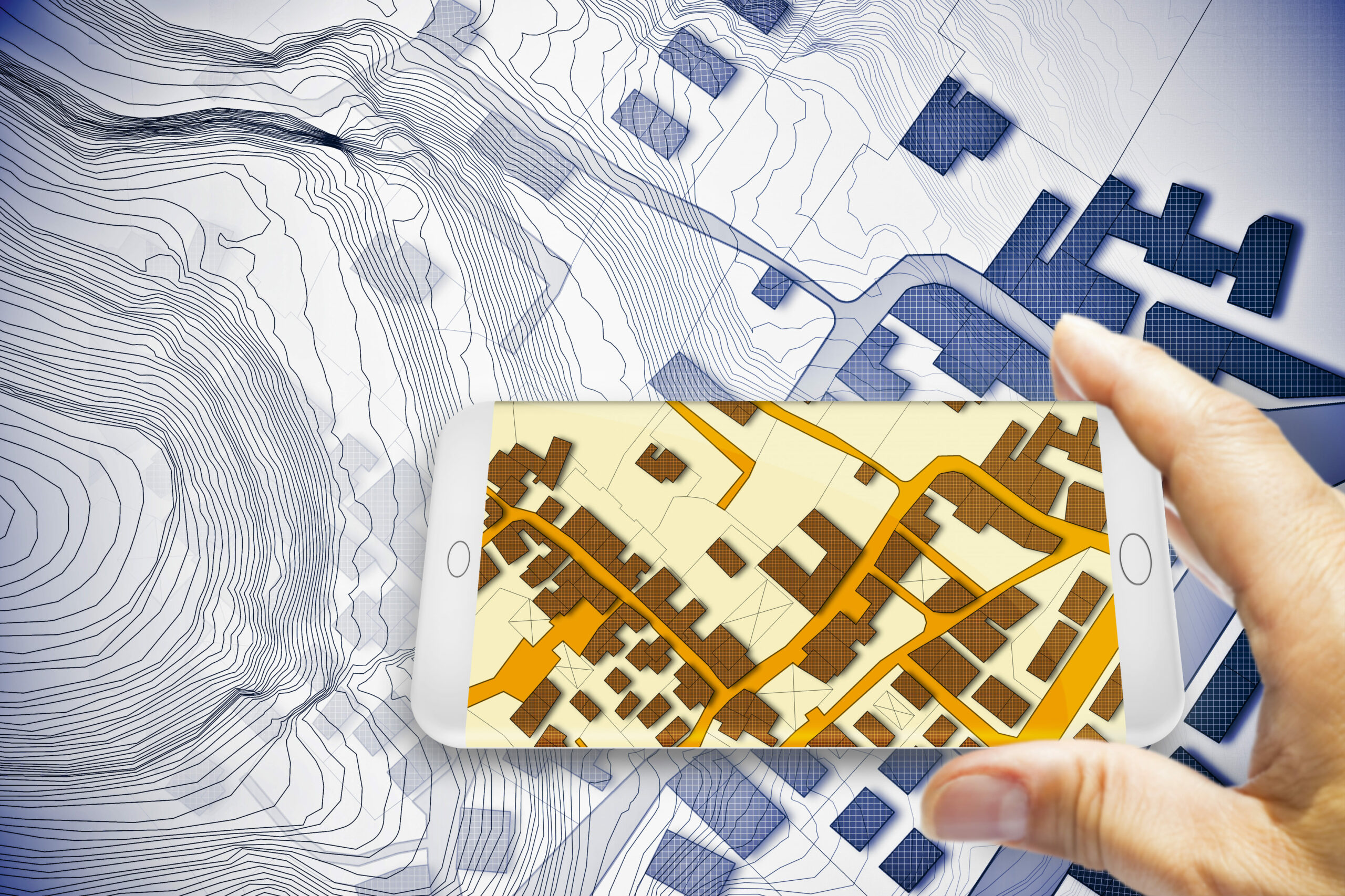
In our rapidly digitizing world, land administration is undergoing a transformative shift. Traditional paper-based records, once the norm, are now being replaced by cutting-edge digital solutions that promise unparalleled accuracy and efficiency. A standout among these innovations is the digital cadastral mapping system — a comprehensive approach that stands to redefine land management, property registration, and even the complex arena of land dispute resolution.
This move towards digital cadastral mapping is more than just a technological upgrade; it’s a comprehensive overhaul. Instead of just transitioning paper records to a digital format, the aim is to amplify and refine the very essence of cadastral data. Such a monumental shift promises a plethora of benefits:
Unparalleled Accuracy: Harnessing geospatial technologies, digital systems depict land parcels with an astounding level of detail and precision. Such detail is paramount for endeavors like urban development, environmental conservation, and infrastructure projects.
Ease of Access: The days of navigating through vast paper records are dwindling. With the digital age, accessing land records is now as simple as a few keystrokes, ensuring efficiency for landowners, administrators, and other stakeholders.
Efficient Dispute Resolution: Ambiguous or incorrect land records have historically been the root of prolonged land disputes. Precise digital mapping promises to mitigate these conflicts, offering clear and interpretable records.
Beyond its function as a digital representation of physical space, geospatial mapping serves as an indispensable tool in the modern land administration toolkit. Its transformational impact is especially palpable for government agencies dealing with land administration.
Government bodies benefit immensely from the shift from paper to digital. For one, it introduces efficiency and accuracy into bureaucratic processes. In regions like the Philippines, digital land titling systems have allowed government agencies to expedite land registration processes, reducing backlogs and ensuring timely service delivery. This digital transformation also bolsters transparency and accountability. In Estonia, the e-Land Register, an online system for land and property titles, offers a transparent and user-friendly interface for citizens, reducing the potential for bureaucratic red tape and corruption.
More broadly, the transition has brought several noteworthy changes to the forefront. For instance, in Rwanda, transitioning to a digital land registration system dramatically reduced land disputes and increased women’s land ownership. The state of Andhra Pradesh in India utilized digital land records to streamline property transactions, reducing fraud and ensuring transparency. Urban planners in cities like New York and Tokyo have leveraged this technology to optimize land use. Meanwhile, in Brazil, geospatial tools have been instrumental in tracking and mitigating deforestation in the Amazon.
By providing a multi-dimensional perspective on land-related issues, geospatial mapping becomes pivotal in facilitating informed decision-making, predicting land-use patterns, and enabling a proactive approach to land management challenges for governments and citizens alike. This technology represents not just an evolutionary step in land administration, but a revolutionary leap towards a future of precision, clarity, and strategic foresight.
However, a transition of this magnitude is fraught with challenges:
In the vast landscape of digital land administration, numerous challenges loom. Yet, with the capabilities of geospatial technology, every challenge presents an opportunity. One of the significant hurdles is the assimilation of historical, paper-based records into new digital systems. Geospatial tools simplify this task by offering automated solutions to digitize, update, and integrate older records, preserving their intrinsic value. Recognizing the variability in technological infrastructure across different regions, geospatial solutions are inherently scalable. They’re designed to accommodate both advanced and emerging infrastructures, ensuring a comprehensive reach in this digital revolution. To ensure a smooth transition, these solutions often come bundled with comprehensive training modules, empowering the workforce accustomed to traditional methods to adeptly navigate and utilize the new systems.
In an era where data security is paramount, geospatial tools employ advanced encryption techniques and secure storage solutions to protect sensitive land records. Moreover, they adapt in tandem with evolving regulatory frameworks, ensuring consistent compliance in a changing legal landscape. Perhaps most importantly, geospatial initiatives prioritize stakeholder engagement, fostering broader acceptance through interactive platforms and awareness sessions. These solutions not only address the challenges of digital transformation but also pave the way for a future where land administration is seamless, efficient, and universally accessible.
The adoption of digital cadastral mapping signals a profound shift in land management, moving beyond mere record-keeping to an era of enhanced clarity, efficiency, and accessibility. This revolutionary approach not only streamlines administrative processes but also builds a robust foundation for informed decision-making, sustainable development, and empowered land governance. As we delve deeper, it becomes evident that this transformation touches every stakeholder, from landowners and urban planners to legal professionals and local communities, each reaping its unique benefits.

The pivot to digital cadastral mapping bestows benefits on a vast array of stakeholders:
The rise of geospatial mapping in land administration isn’t merely a present-day advancement; it’s a foresight into the transformative future of how societies interact with land. As our world becomes increasingly interconnected and urbanized, the need for precise, transparent, and accessible land data becomes paramount. For cities of the future, digital cadastral mapping will play a pivotal role in sustainable urban planning, ensuring that growth is harmonized with environmental preservation and social inclusivity. For governments, it means heightened accountability and citizen trust as land records become transparent and dispute resolutions more efficient. Furthermore, with the integration of technologies like Artificial Intelligence and IoT, the potential for predictive land-use modeling, real-time monitoring, and dynamic land management becomes conceivable. In essence, the fusion of geospatial technology and land administration is paving the way for a harmonized, sustainable, and empowered global community.
Magnasoft, a seasoned player in the geospatial realm with over two decades of industry experience, stands as a beacon of innovation and reliability. Having been at the forefront of the geospatial industry for over 20 years, we have a proven track record of successfully executing complex land administration, infrastructure development, and digital transformation projects across the globe. This rich heritage equips us with unparalleled insights and deep-rooted expertise, enabling us to navigate the intricate nuances of the sector.
Our unwavering commitment to quality, combined with our innate understanding of the sector’s dynamic needs, has been pivotal in forging long-standing partnerships with governments, organizations, and businesses worldwide. This legacy of trust and excellence has cemented Magnasoft’s reputation as a trusted partner for entities eager to harness geospatial solutions for progressive outcomes.
Magnasoft: Land Administration Services
The metamorphosis from traditional to digital in land administration signifies more than just a technological evolution. It marks a journey towards a future where land rights are crystal clear, disputes are minimized, and information is accessible at the fingertips. As geospatial technology continues its march forward, its potential to reshape our perceptions and management of land becomes ever clearer. The future is digital, and it’s transformative.
Transforming land administration requires the right expertise and tools. If you’re looking to integrate digital cadastral mapping into your operations or wish to understand more about its potential for your business, we’re here to help.
Unlock the benefits of geospatial solutions with Magnasoft.
Get in touch with our experts today and embark on your journey towards efficient and innovative land management!