Why 4D BIM?

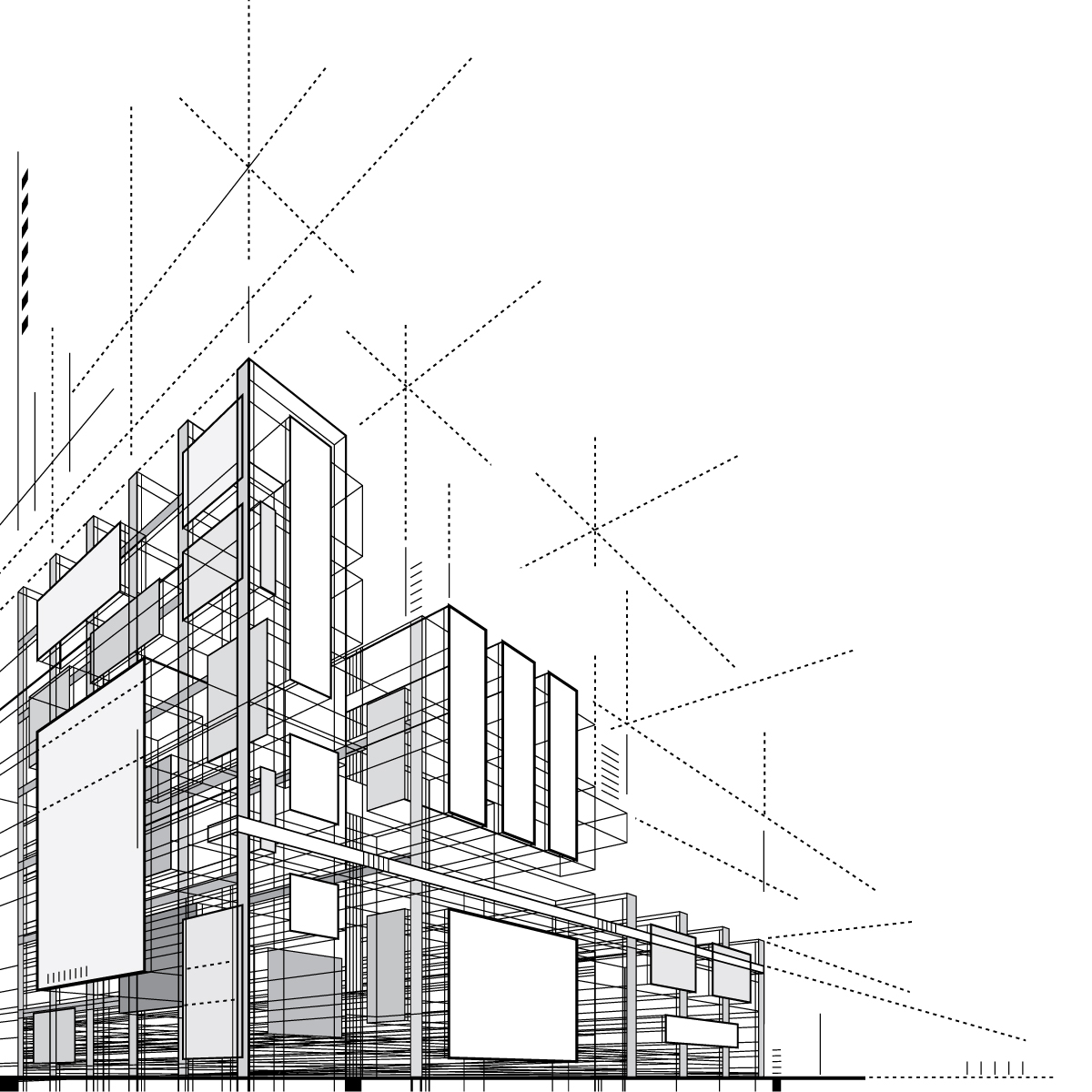
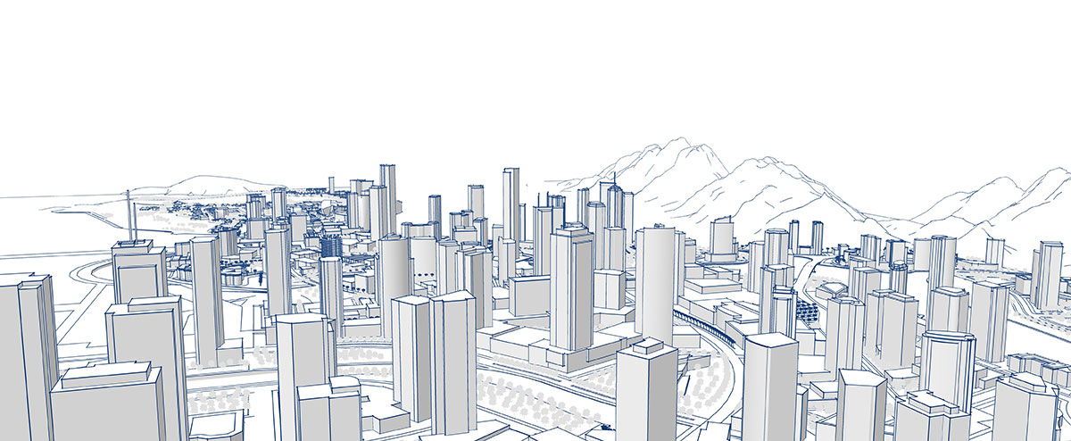
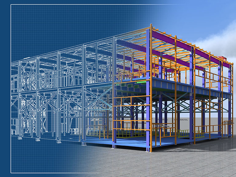
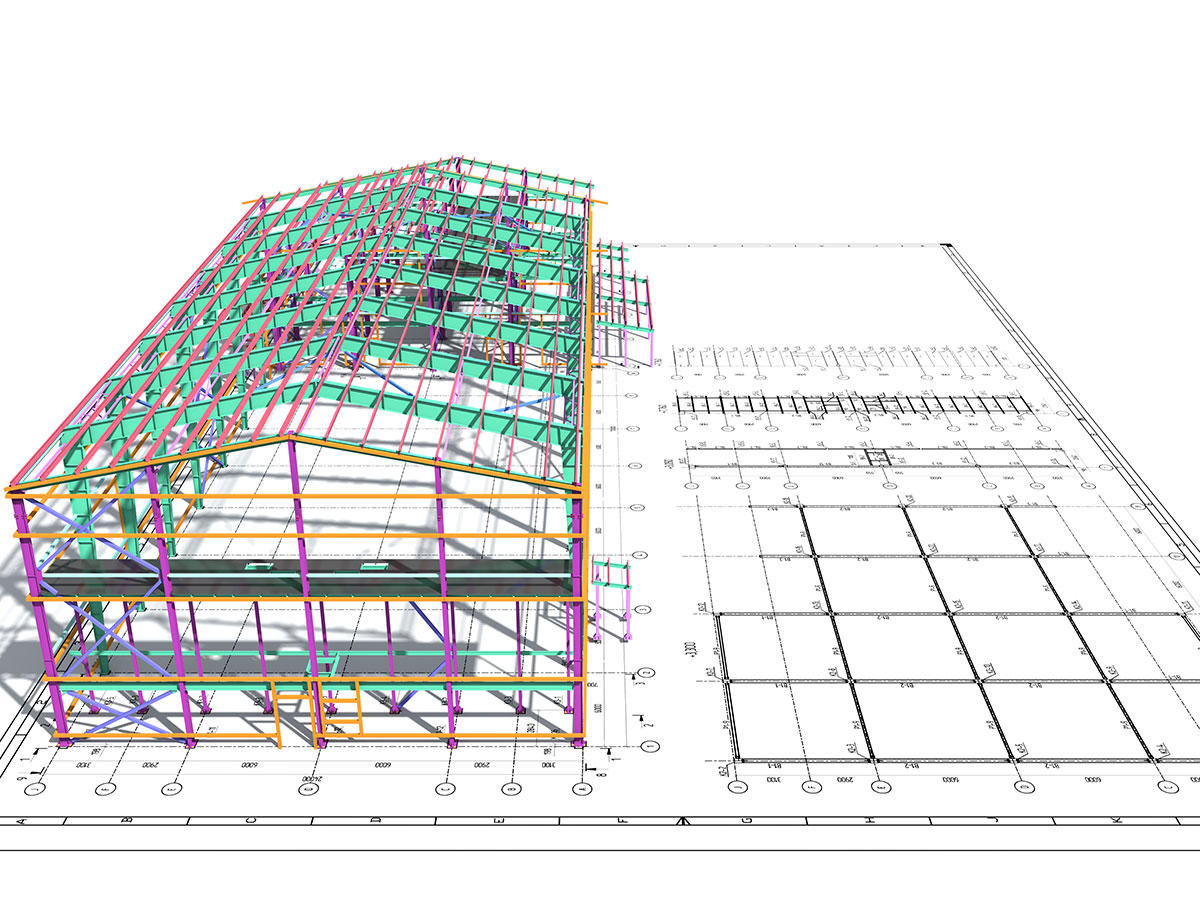
Put simply, 3D BIM is the process of creating graphical and non-graphical information and sharing this information in a Common Data Environment (CDE). This information becomes richer in detail as the project lifecycle progresses. 

What’s with 4D?

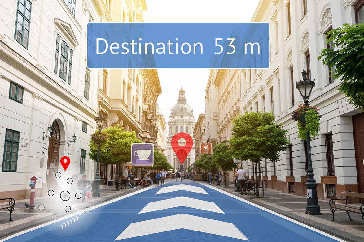
Now, let’s add an extra dimension of information to the project information model in the form of scheduling data and you have brought the fourth dimension to BIM. Adding this extra information enables the stakeholders to take more timely decisions, and ultimately build better buildings. From 3D to 4D, the dimension of ‘time’ is added to the information model. 4D explains how something will be over a period of time. When you break your 3D model down into pieces which will be built according to a certain schedule, you have brought in 4D to your construction project! 

To give a definition of 4D BIM, “It refers to the 3D visualization model of a construction project including construction scheduling and sequencing.” By adding scheduling data of the project even before the construction begins, 4D BIM empowers the stakeholders to analyze events sequentially using project information and visualization. This early sequencing enables the stakeholders to assess the various possibilities and accordingly take actions to improve project planning and risk management. Visualization of the structure as it gets built leads to huge savings in terms of cost and time as fallacies can get pointed out early.

Enabling location-based scheduling

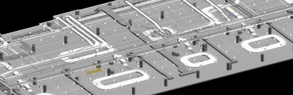
4D BIM offers better spatial insight than 2D and 3D. 4D BIM can help in maximizing the value of location-based scheduling. Location-based 4D BIM can help in enriching the planning and scheduling processes in a construction project. It also improves communications among stakeholders, resulting in better outcomes.

Managing a construction project is a daunting task. Thus, a single integrated model which clearly projects the ‘when’ and ‘where’ of each construction activity can largely help in determining the correct project delivery approach and execution. Location-based 4D BIM helps in achieving just that.

4D BIM with AI

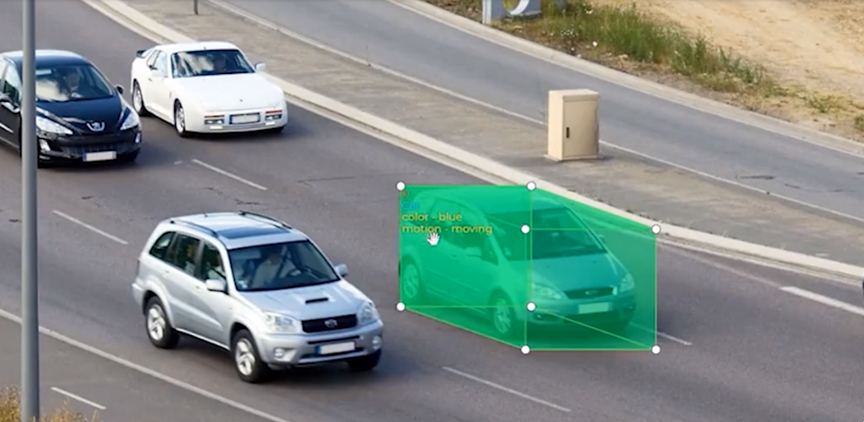
4D BIM, when coupled with the capabilities of AI can help in achieving extraordinary outcomes in your construction project. Using 4D BIM with AI, stakeholders can visualize the project and experience the progress in real time. 4D BIM with AI leads to better collaboration, higher safety, more streamlined field operations and eventually more time-saving, cost-effective results.

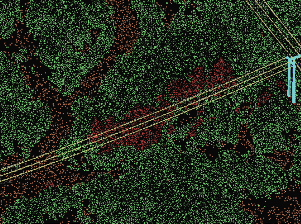
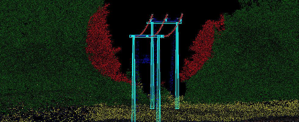
In case of large construction projects such as airports, transit systems, bridges, and tunnels, it becomes a huge challenge to track the progress of each activity. While traditional methods of tracking include generation of a wide range of reports, which are susceptible to errors, 4D BIM AI-based video monitoring solutions can provide sequential animation of all activities. Needless to say, this method of presentation offers a better understanding of the progress. The visual comparison of what was planned against what is done on-site brings in more efficacies in the final outcomes.

Along with infusing more collaboration among team members, 4D BIM with real-time AI plays an instrumental role in reducing on-site risks and injuries. Moreover, since all construction site activities are recorded digitally, the risk of a data breach or misplaced paperwork is removed.

Also Read: Information in three dimensions is more trustworthy

Conclusion

Managing a construction site is a challenging task. It is critical for project managers to have access to the most accurate, up-to-date information from the job site all the time. 4D BIM helps in gaining that information. By adding an extra dimension of scheduling data to the project information model, it enables project planners, architects and other stakeholders to obtain accurate  information and visualizations about the project in real-time. It shows how the project is developing sequentially.

This information becomes very useful in identifying potential issues at an early stage. 4D BIM gives everyone clear visual understanding of every stage of the project, from what is planned to what the finished construction will look like. This clear understanding allows everyone to have better control over the project. 

The world of construction is rapidly evolving and becoming more and more technology savvy. Moving ahead from reaping the benefits of accurate 3D models, it is fast adopting 4D BIM and higher levels. With adoption of 4D, 5D, 6D and 7D BIM in the construction projects, the stakeholders are gearing up to achieve improved site planning and scheduling optimization, seamless coordination among teams, enhanced preparedness at each stage of construction, a more collaborative environment focused on information sharing, reduced delays, and higher safety and efficiency in their construction projects. 

A growth mindset is the need of the hour, and to help you in this digital transformation journey of yours we are keen to offer our expert help. Years of experience spread over diverse projects across the globe give us the confidence to be your best digital partner. 

Also Read: Why do 3D Mapping?

Managing Utility Data for Optimum Efficiency

In case of utilities, geospatial data is not only helping in monitoring the performance of infrastructure, but also enabling better management of underground utilities by providing easier access to information about them. Spatial data is aiding in generating insights, analyzing, visualizing and monitoring the utility assets. 

Across the world, the utility sector is focusing more and more on adoption of digital technologies for achieving better performance. Data plays a pivotal role in this digital transformation journey of utilities. However, some challenges occur when it comes to getting quality data. Due to the huge volume of data the utility sector is swamped with on a regular basis, it often becomes challenging for the managers to achieve desired outcomes in data sourcing, processing, curation, validation and management .

Data Management for Utilities 

To achieve sustainable growth, it is important for the utility sector to have energy usage reduction goals. To achieve this goal, the stakeholders need a solid benchmark of current usage and that’s what a robust energy data management system can provide with. The historical data can be used to make predictions about the future usage.  A data-driven strategy can also aid in clean energy adoption.

The right kind of data can bring significant improvements in utility planning, market segmentation and engagements with customers. But the task becomes challenging with inputs received from a wide variety of sources and considering the complexity of GIS, SCADA, smart meter and CIS systems. However, data management can become simpler with the help of the right partner. A platform that combines the prowess of machines and humans can be the answer to all problems in utility data management. 

For achieving efficacy in utility data validation, cleansing, analysis and more, expert help is advised. An expert utility data service provider can help you in managing and visualizing your utility data.  A unified data management framework, by efficiently consolidating the data from disparate sources, tracking data lineage and reducing errors and inconsistencies can help in achieving the highest quality in the data. Along with ensuring that the data conforms to established standards and regulations, the framework can prepare the data for analytics and reporting. A framework brings in successful outcomes by ensuring that the accountability is fixed, data ownership is assigned and a focused approach is followed to achieve data improvement.

Conclusion 

Poor quality data is an ongoing challenge for the utility sector. This mainly happens because massive volumes of data keep pouring in from disparate sources. To make this data useful for analysis, it has to be validated, curated, cleaned and managed well. While automated tools ease the process, 100% efficiency is achieved only with the help of human expertise. 

Effective data management is the key to success here.

Good quality utility data lays the foundation for successful energy management. Validated, standardized data is critical for the utility industry and the stakeholders should not think twice before investing in efforts which can help them in achieving the highest standards in data quality, governance, management, analytics and more.  

This is necessary, if we desire to have a safer, greener world for our future generations.

Digital Twins: Promising Excellence in AEC

Digital twins facilitate data analysis and monitoring of systems, helping project managers to identify problems early. This early identification of issues leads to huge savings in terms of time and cost. By making the required changes in the digital model of the infrastructure, the stakeholders are able to achieve higher safety and efficiency in building and maintaining the assets.

By leveraging digital twins along with the application of analytics, artificial intelligence and machine learning throughout a project’s lifecycle, stakeholders can achieve par excellence outcomes in their infrastructure projects.

Digital Twins and Smart Cities

With the world diligently working towards developing smart cities, the digital twin technology becomes more relevant. Digital twins are capable of bringing high level of effectiveness in all aspects of city governance, right from urban planning to land-use optimization. Simulations offered by digital twins allow the problems to come to surface much before they become a reality. 

As the leaders in the AEC sector believe, digital twin mapping is mandatory for any city looking at digital transformation. Digital twins lay the foundation for effective analysis of the data to discover what can be done to achieve improved living conditions for the citizens. The benefits in terms of energy consumption, waste management, security monitoring, mobility improvements and infrastructure management that these data-rich digital models of the city are capable of offering are unmatched. The cities that leverage the digital twin technology are inadvertently poised to become more environmentally, economically and socially sustainable. 

Digital twin solutions can enable the infrastructure project stakeholders to visualize, process and analyze multiple, large and complex georeferenced data. Digital twins aggregate massive amounts of information for everything within a project’s lifecycle ecosystem. By becoming a massive master data library, they enable users to run analysis in an unprecedented manner. For instance, they allow planners to virtually test new systems, such as 5G deployment over a defined area and identify improvements much before the actual installation takes place. 

Following the trend of adopting digital twins in AEC, Singapore became one of the first cities to build a 3D interactive model of the entire city. The model included detailed information, including texture, material representation of geometrical objects and terrain. It included static, dynamic, and real-time city data such as demographics, pedestrian and vehicular movement and climate. The 3D model enabled the city to achieve optimum outcomes in urban planning, city governance, citizen services and more.

Towards Development of Standards

The concept of digital twins is new for AEC, however, it likely to become widely popular within the next five to ten years. Research indicates that by 2025, around 500 cities globally will be using the digital twin technology for their infrastructure projects. Along with helping in making desired modifications in existing infrastructure, digital twins will be used for designing new cities. The concept of digital twin is being expanded to foresee the creation of digital national twins, which would connect a country’s urban twins into a national platform. That development will include development of standards, guidance, specifications and new products.

The UK government established a National Digital Twin Program in 2018. The aim was to enable the building of a National Digital Twin (NDT). To aid the development of the NDT, the Centre for Digital Built Britain has formulated The Gemini Principles, which are nine basic values that guide the development of the NDT.

Another body that is playing an important role in increasing the adoption of the digital twin technology worldwide by creating awareness about the benefits is the Digital Twin Consortium. It is a global ecosystem of users who are accelerating the digital twin market and demonstrating the value of digital twin technology. 

These initiatives illustrate the pace of development of the digital twin technology for AEC. Magnasoft provides digital twin mapping services to create 3D digital replicas to plan, test and monitor their physical, economic and community structures. Over the years, it has emerged as a Digital Twin Platform enabler offering complete Data Services Program Management – collection, processing, governance, change management, updating and analysis at all phases of the project. Such a platform enables the stakeholders to have a single point ownership, eliminating the hassle and saving time in dealing with multiple parties and contracts. 

Our digital twin mapping services is allowing more and more organizations, governments and industries to successfully manage their assets. With global success stories in our repertoire, we are confident of providing high-quality digital twin services, thereby playing an important role in making the technology more mainstream, especially in AEC.

New eyes to construction…

Digital transformation in the AEC sector is happening at a rapid pace. Moving from 2D, it is fast adopting 3D BIM Modelling, topping it up with advanced technologies like AR/VR/MR. The reasons for these transformations are worth exploring.

Better Project Management 

Moving beyond gaming and entertainment, Augmented Reality is creating waves in construction. It is helping the stakeholders to achieve excellence in all phases of a project’s lifecycle, right from project planning to communications. It is helping in winning projects, achieving better collaboration with team members and even improving safety.

AR/VR enables architects, designers, engineers, project managers, service providers and other stakeholders to create a virtual copy of what they are planning to create. It involves placing a 3D model of a proposed design onto an existing space using mobile devices and 3D models. With the help of AR and 3D models, designers and architects can effectively evaluate designs for feasibility, function, and aesthetics. 

3D virtual tours allow client to have direct access to site progress without getting mud on their boots! A virtual walkthrough leads to more meticulous planning, such as deciding where materials should be laid, where walls should meet and where doors should be placed. Walkthroughs can also help in understanding the routing services such as HVAC ducts, water pipes and electrical conduits better. AR can help in early identification of the design issues, thereby saving time, cost and efforts. 

Improved Inspections & Safety 

BIM when coupled with AR largely aids in inspection of projects. Visual comparison between the ‘as-designed’ and ‘as-built’ can pinpoint the gaps and corrective actions can be taken before moving to advanced construction stages. AR can also significantly help in identifying hidden infrastructure —beams and other structural members, ducts, conduits and pipes.  Many construction hazards can thus also be avoided.

Enhanced Collaboration

A construction project involves multiple teams working together towards the accomplishment of the common goal. These teams need to collaborate continuously for the successful completion of the project. AR can help in achieving good collaboration between the teams without the need of everyone being present on the site at the same time. Errors can be reviewed in real-time and consensus can be achieved in a better way using AR/VR. Users can take notes and share video views of issues and send the information to any remote teams in real time. This kind of enhanced visualization and coordination lead to better decision making. Timely decisions lead to huge savings in time and cost.

By integrating AR into BIM, companies are able to more accurately document key construction achievements in an interactive format. They can also communicate about the progress of the project to the stakeholders more effectively. This leads to higher transparency throughout all the phases of a project.

Conclusion

The construction job sites are rapidly changing. Digital transformation is becoming an integral part of infrastructure. Coupling 3D modelling with extraordinary technologies like augmented reality, virtual reality and mixed reality, leaders in the AEC are scaling up the projects immensely. Blurring the boundaries between the digital and physical worlds, these technologies are helping construction teams to achieve more efficiency in their projects. 

Walkthroughs facilitated by AR/VR provide extraordinary site view experiences for clients as well as architects, designers, engineers, project managers and other stakeholders. As the technologies continue to mature, they will become invaluable tools for AEC. Highly accurate 3D models, which we specialize in developing, form the base of world class infrastructure. Add to that the capabilities of AR, VR or MR and the possibilities are just limitless!!

Actually Gliding Through!

Augmented Reality (AR) in Navigation tells a similar story. AR is enabling everyone to create more engaging stories, understand data better and interact more beautifully with the communities.

Discover a new world with AR 3D maps 

Navigation, which has anyways got totally transformed with digital maps, moving from 2D to 3D, is now gaining unmatched depth with integration of AR. AR 3D mapping tools can help in building really cool content for the new mixed reality world. The AR world depends on dynamic, accurate 3D maps. These maps enable users to discover the world in new innovative ways. AR maps allow you to get vital details about an object just by pointing your phone to it. While navigating, you can view photos, reviews, contact information and more in 3D for points of interest like restaurants, Wi-Fi hotspots, gyms, etc. AR 3D Maps provide a new way to experience what we see, hear and feel. The possibilities are immense and this is the reason the leaders in the mapmaking business are imbibing the technology in their applications at a fast pace.

Maps and AR 

Leading mapmakers have been working towards bringing augmented reality to their maps to provide their users a high level of navigation experience while walking and driving. These applications use the camera on the user’s phone to identify where he or she is. Thereby, instead of just presenting the user with a map, they show direction and details on the display. This way, maps with AR capabilities help the users in choosing the right way to go. With such displays, you are not likely to get lost ever while travelling! Such high level of clarity enhances the user’s navigation experience immensely.

New-age maps with AR capabilities include richer elevation data, additional road colors, rich labels and new 3D landmarks. Advanced technologies are enabling navigation maps to display crosswalks, lanes and even rendered overlapping intersections as the users navigate. AR 3D Maps can make navigation more exciting with innovative features like a moonlight glow over 3D buildings at night! As stated earlier, the possibilities are endless!

Conclusion

While maps and geolocation apps have transformed the way we travel, AR solutions are coming to rescue where the basic maps become limited in their capabilities. Additionally, they are making the navigation experience more enjoyable. AR geolocation shows users exactly where they are and in which direction they need to go to reach their destination. AR maps are a powerful addition to navigation experiences. 

AR in navigation depends on highly accurate 3D Maps. As a leader in this domain, we are well-equipped to be a strong contributor in this transformative journey of mapmakers, app developers, game developers, social engagement platforms and the like. Let’s create smarter routes and more enjoyable immersive experiences together!

The AEC market is witnessing huge investments; Investments drive transformations

Useful insights from Ganesh Deshmukh, General Manager Sales-Infrastructure during an interview as he joins the team of Magnasoft. 

How the AEC market is evolving with the changing times? 

The AEC market is definitely maturing, more appropriately evolving and the trends are definitely encouraging. Three pillars namely “People”, “Process” and “Technology” drive the transformation of any industry and AEC is not an exception to this.  We observe that all these three pillars have matured over the years and will evolve more in future. 

I see huge investments happening in infrastructure projects around the globe and strongly believe that any change/transformation is directly proportional to the investments. The financial will is an important aspect to see that type of change and maturity. So, the growing investments are adding pressure on the complete supply chain of the AEC market. The growing pressure is allowing people to think differently to deliver the projects on time and on budget. 

Digital technologies are also emerging and helping drive that transformation. So, the expectations are definitely changing from each other. For example, owners are expecting better visibility into every phase of the project. They are aware that the technology is available to get those insights. So, there is an expectation from the general contractors, program managers to implement a digital platform that can help them with such analytics and help them in decision making.  There are many such examples that can be cited on changing expectations.

I believe that changing expectations keep everyone on toes and drive innovation. That is a very positive sign. AEC has been very traditional for the longest time and is far behind in terms of technological advancements and adoption but it is catching up very quickly.

Post pandemic, where do you see the maximum action happening within the AEC sector?  

The pandemic has completely changed the way we work, we behave professionally, socially, communicate, collaborate etc. The AEC market is also facing changes. Construction needs labours to be present on the site but the labour rates have gone up due to increase in safety norms that have been imposed by the governing authorities. Architectural, Engineering and project management profiles remain less unaffected. New technologies are being implemented and embraced to limit the effect of current pandemic.

Emerging digital technologies is where I see maximum action happening in the AEC sector. As per Deloitte Report on “2021 Engineering and Construction Industry Outlook” the engineering companies who had embraced digital technologies learning from 2008 recession was impacted less and suffered less losses.

The technologies that are gaining maximum traction in the AEC sector are Drone technologies to capture live feeds and images of the construction site in order to monitor the construction progress sitting in office and avoiding trips to the site, thus saving cost and not compromising on human safety. Other technologies are Artificial Intelligence/ Machine learning (AI/ML), Augmented Reality (AR), Virtual Reality (VR), Building information modelling, creation of digital twin platforms for collaboration, design reviews, validation, handover, operational analytics etc. Automation using self-driving vehicles and drones performing repetitive tasks to deliver the project on time and on budget is another emerging technology trend in the construction industry.

How well do you think Magnasoft is prepared to make an impact in this changing scenario? How do you individually aim to contribute?  

Magnasoft has been working in the technology sphere of the AEC market from the last 20 years and has garnered tremendous experience. Since its foundation the technology has evolved ten folds and Magnasoft has been witness to it.  Magnasoft has kept evolving based on the changing market trends. It implies that Magnasoft understands the market well and understands what it takes to drive the innovation and digital transformation to help the AEC market to deliver the projects on time and on budget. Magnasoft is also investing; learning and embracing new emerging technologies and getting ready to create an impact in the changing scenario. 

I have gathered lot of experience and expertise (over 10 years) in solving business problems of the engineering community especially in the infrastructure vertical using digital technologies in my previous profile with Bentley Systems. Currently, I am extensively doing market research on the emerging technologies and trends as well as talking to my industry friends, connections and ex-colleagues to understand the deeper problems in the AEC market. The plan is then to come up with a solution (involving the emerging technologies we talked about) and a service model to attack and eliminate those problems thus creating a long term value for our customers.

In which areas do you feel Magnasoft needs to strengthen its abilities to make a stronger impact in AEC/infrastructure?

Magnasoft has already created a mark in the bottom layer of the pyramid i.e. data collection and data processing and the intent is to move up the value chain by adding layers on top such as data management, data governance, change management, analytics, customizations etc. So, the focus is on expanding our resource base and strengthening our abilities and creating expertise for the added layers. 

Digital twin, AI/ML, Video/Image analytics are other areas gaining lot of momentum in the construction industry, and I strongly feel we should start putting a road map in place to create expertise around it.

How well Magnasoft is placed in its Digital Twin offerings?

Digital Twin is a buzzword these days in the market and many technology players such as Bentley, Willow, Dassault, Autodesk, Invicara etc. have developed Digital Twin platforms. 

It’s  true that the digital twin platforms are there, but the core questions are: who is going to make these platforms reliable in operations, who is going to make these platforms IOT ready, where will the data come from , who will maintain and update the data etc.  A huge gap exists there and Magnasoft has the expertise, resources and experience to fill that gap. Magnasoft is equipped to become the single point of ownership to run the services program thus saving time invested by clients on multiparty interactions. 

Why do you think it is the right time for Magnasoft to focus on the Infrastructure market?

President Biden recently announced a $2 Trillion plan to re-build infrastructure and reshape the economy. The bill includes a significant funding of $225 Billion in infrastructure domain that includes airports, roads, bridges, ports etc. So, there is definitely a huge financial will out there and focusing on that market is a natural instinct. As per reports from leading consultants such as Mckinsey and Deloitte, huge digital investments are happening in the E&C market especially in digital twins, 3DBIM++, digital supply networks, autonomous rovers & drones, predictive maintenance. Magnasoft being in that digital space for the last 20 years and definitely will add lot of value in solving the deeper problems.

Anything else you would like to share? 

Globally every market is recouping from the post pandemic effects and so is the AEC market.  But I see a huge technological disruption in that market with new technologies and new players emerging and everyone claiming to solve the problems. I think the intense competition will prove beneficial and better technologies will emerge thus proving beneficial to our customers. Magnasoft has over 20+ years of experience in digitizing the world using geospatial and engineering technologies, so we are gearing up to be a key player in this changing market of increased expectations and demands. We are getting prepared to make a bigger difference. 

Smart Airports: Optimizing Passenger Flows & Operations

We are now in the era of ‘smart airports’, which along with location intelligence are using advanced technologies like IoT, GPS and sensors to enhance operational efficiency and passenger experience. 

Smart airports are becoming ‘a place to be’ for travelers. These airports, using smart technologies are able to scale new heights in facility management & asset management, thereby providing the users with the pleasure of shorter check-in queues, more streamlined security procedures, easier wayfinding and real-time updates. Geospatial remains an important enabler in this dynamic scenario.

Seamless Operations

For the smart airports to function smoothly, many complex activities are to be managed most effectively.  GIS enables the stakeholders to easily integrate dynamic information from different systems, thus providing them with a comprehensive view of the major airport operations, if not all. This detailed and integrated view allows easy and quick identification of the bottlenecks, leading to faster, more informed decisions for smooth operations.

Better infrastructure management

For maximizing revenue generation, airports need to ensure that the space available is used optimally. They need to ensure optimum management of their terminal and landside real estate, while providing enhanced customer experience. GIS and allied technologies help the airports to get more from their infrastructure. Using highly accurate 3D models, as provided by experts like Magnasoft, the smart airports can achieve unmatched performance in airfield inspections, pavement management, terminal work orders, runway signage and more. Geospatial technologies can help airports significantly in controlling costs and optimizing asset performance. This better management of assets eventually leads to better preservation and prolonged life cycle of the most valuable assets.

Enhanced safety and security

Geospatial technologies help in increasing situational awareness. Accurate 3D models of the airports along with GIS systems enable the security personnel to have a better grip over the landscape of the building at all times. They are able to quickly identify problems and take corrective actions, thus avoiding major catastrophes. 

Ensuring positive passenger journeys

Passengers remain at the heart of the airport operations. Rich demographic and mobility data allows airports to gain enhanced understanding of the passenger movements and behaviors. Using this knowledge, they can expand their catchment areas and better customize the customer experiences. Geospatial facilitates positive airport passenger experiences.

Smarter designs

Integration of GIS, CAD and BIM data leads to smarter designs of airports, ensuring careful land use and environmental planning. 

Easier access to information

Large volumes of data come through the network of sensors, beacons and cameras in a smart airport. This data can be analyzed to increase efficiency. With smart technologies in place, travelers can receive important information about flight delays and other important updates. On reaching the airport, they can receive information about closest parking slots available and when inside the airport, they can benefit from alerts on gate changes, boarding status, baggage claim information and more. 

3D maps make it easier for travelers to locate terminals, food options, restrooms, and other important locations right from a mobile device. With technologies like Augmented Reality in place, these experiences are becoming more enjoyable and useful.

Conclusion

Customer expectations from airports are rising. As airports prepare for effective functioning in the post COVID world, the answer lies in digital re-engineering. Airport data analytics is one of the major instruments that would change airport operations. Automated communication, real-time data, GIS, 3D modelling, AR/VR are the technologies that will drive this change. Integration of these technologies in airport construction & management will lead to immaculate precision in visualization, enabling the stakeholders to get a clearer picture at every stage. This accuracy & timely analysis will lead to better and more informed decisions.

On the basis of our vast experience in delivering optimal solutions for a large number of airports at global level, we are enthused to become a preferred partner in this growth journey. Our Airport Solutions will surely pave way for better managed airports & happier travelers. 

Geospatial and 5G Networks: An Unwavering Bond

How can 3D city models aid in planning for 5G networks?

3D city models can aid in planning for 5G networks primarily in three ways. Firstly, they can help in identifying the best site for tower location. 5G networks require significantly more towers than other networks to propagate the signals. Thus, it is very important to optimize the number of towers required, still ensuring best network coverage. Accurate 3D city models can help in achieving this. Quality 3D city models can help in achieving good quality network coverage. 

Secondly, 3D city models can help in identifying the existing city infrastructure, for instance, existing electric poles, which can be used for setting up the antennas. 

Thirdly, 3D technologies can help in modelling the existing telecom towers. This can help in identifying how much capacity of these towers is free for usage. Currently in India the tenancy of these towers is lesser, which can easily be increased. This can be achieved through 3D modelling of towers and having accurate information of tenancy.

What are the major challenges that occur while creating sub-meter level precision in 3D?

Challenges spring from the source data itself. For having sub meter level accuracy in 3D city models, it is important to have quality source data like aerial imagery, LiDAR datasets etc. In India, because of the new geospatial policy, it is now possible to have high resolution datasets. 

Availability of trained resources is another challenge. The process of collecting, processing and modelling the data requires highly skilled manpower and experience. Since the technology is yet to mature, skilled resources are not easily available. 

Another big challenge is to handle the huge datasets. Challenges exist in storage, processing and analysis of data. Only companies which understand these challenges and are equipped with the right skillset to handle these can deliver high quality 3D city models.  

What are the key aspects considered for timely delivery of geospatial projects (Especially in rollout of 5G technology)?

For 5G rollout, telecom operators are in advanced stages of acquiring the technologies and licenses. Geospatial companies need to mature the processes and identify the right data models, specifications and accuracy standards that are suitable for 5G network planning. Magnasoft has set up the right workflows, standards and achieved maturity in the use of these technologies. Additionally, the tools used by telecom companies, the consuming technologies also need to mature. From delivery perspective, skill building of people can aid in achieving timely deliveries.

How well is Magnasoft prepared to enable telecom companies to have more robust 5G networks?

Magnasoft has been working in the 3D modelling space for 15+ years. We understand the nuances of development of high quality 3D city models. Using the experience we offer custom solutions for 5G network planning. We use a tailor-made data model for 5G networks that can help in optimal network planning and updating the networks. We are also helping the customers in continuously updating the 3D city models. As the city changes, consumption, coverage pattern etc. changes, accordingly, the telecom companies need updated city models, which we provide.

Please elaborate on the concept of combining IoT and Geospatial for achieving excellence in projects.

IoT has become popular in the last 10 years. We can naturally integrate IoT & geospatial for better outcomes. For instance, IoT sensors can be used inside indoor building models of malls or airports. The combination of IoT and Geospatial also helps in better monitoring of assets. Airports are almost like a city by infrastructure; you have restaurants, shops, places for rest for passengers etc. If you have 3D indoor dataset for an airport and have integrated IoT sensors, you can efficiently manage airport operations and improve user experience. 

In case of 5G networks, IoT devices are used for monitoring the telecom infrastructure and maintaining them. They continuously keep transmitting information about the health of assets and thus aid in quick resolve of issues and providing better services. They can help in early identification of equipment malfunction, power outages etc. and result in immediate action. 

What are the 3 major areas where Magnasoft is planning to make an impact in the near future with its services/solutions?

Magnasoft has been in the 3D technology space for long, helping several industries achieve excellence in their deliveries. We have been largely enabling the utilities industry, especially in power distribution and transmission and that remains a focus area. Second is the AEC industry where we are helping the engineering and construction companies create BIM models and indoor models. Thirdly, we are focused towards helping the airports in lifecycle management. We are looking at providing high quality datasets to help the airports managers manage the assets and achieve operational excellence.

Information in three dimensions is more trustworthy

The power utilities industry is expected to lead this transition. To understand better which technologies, tools and practices will aid the industry to accelerate, we engaged into an interaction with Mike McGill, an expert in the utility segment.

Why is 3D mapping important for utilities?

Industry trends such as risk management and an evolving workforce are incentivizing electric utilities to establish and maintain better information about their assets. We live in a 3D world and therefore the people who are developing better asset databases have a natural proclivity towards representing this information in 3D.

In short, 3D mapping and asset information is more relatable to the people who need it and therefore drives certain inherent efficiencies. For example, one of the greatest contributors to cost and risk is the deployment of field crews. Traditional 2D mapping and asset information contributed to reducing field visits, but not to an optimal extent. It is natural for people to want to see data in a way that represents the real world. The more we can present information in three dimensions or better yet as a digital twin, the more people will trust it and use it and in pursuit of mitigating risk, deriving better answers and introducing new efficiencies to asset management.

What changes have you witnessed in power distribution systems over the years?

A major change that I have witnessed is an increase in the use of structural analysis applications like PoleForeman, OCalc Pro and SPIDACalc in the design process. Historically, distribution teams have not had the luxury of budgeting the use of applications like PLS for the placement of utility poles. High profile incidents such as fires in the west and hurricanes in the east have introduced significant cost and personal pain due to outages and loss of life. While structural analysis has always been used in distribution, it tended to lean in the direction of slide rules, spreadsheets and overbuilds. In today’s world of increased liability, it’s important that a utility associates design decisions to a model. These applications are making it easier to model recommendations prior to construction and therefore adoption of these applications is growing.

Effective vegetation monitoring & analysis is an ongoing challenge for the utility industry. How well do you think the industry is placed with availability of good solutions?

Vegetation monitoring and analysis solutions are clearly advancing as measured by multiple companies offering solutions that improve traditional vegetation management processes. I see three drivers contributing to this advancement, data proliferation, cloud-based parallel processing and Artificial Intelligence / Machine Learning (AI/ML). Between LiDAR, Optical and other sensors operating from space, aircraft (including drones), cars and people, we do not suffer from a lack of data. The proliferation of data is creating a mandate for processing and conversion of data to answers. This mandate is bringing AI/ML into the mainstream and the availability of massive parallel computer processing on demand is broadening access to this capability.

Magnasoft is in a great position to support and advance these drivers because of its lineage in data processing and continual pursuit of balancing the application of people and technology in the conversion of data to produce answers for our customers.  Specifically, AI and Machine Learning algorithms require consistent and accurate data applied to training workflows that enable humans to train the algorithms. Magnasoft has been producing consistently accurate data for more than 20 years. This includes ongoing development of workflows that are necessary for development of AI / ML libraries that help us automate the production of maps that tell our customers where and when to trim or remove vegetation.

The telecommunication industry is witnessing unprecedented changes with 5G. How do you foresee Magnasoft becoming an important facilitator of this change?

From my vantage point, the biggest barrier to the future of 5G is the time and cost associated with design and permitting. One of the prominent companies in the US recently reported that it’s taking them up to 36 months to integrate and bring new 5G radios online. LiDAR and related field data collection technologies have the potential to help alleviate this bottleneck by reducing field data collection time while producing consistently accurate data.

Unfortunately, the time saved in the field is equating to more time needed in the back office. More time is getting consumed in processing the data and producing the models needed for structural integrity and visualization to ensure that the aesthetics of the equipment align with community guidelines. Magnasoft’s extensive experience in creating consistently accurate 3D models and automating permit production will definitely contribute to alleviating a significant part of the bottleneck.

What are the major types of solutions which the utility industry is looking forward to having to achieve operational excellence?

I see two interesting developments. First, the utility industry began to invest in GIS approximately 25 years ago and it appears that it’s time for those systems to be overhauled in exchange for the next generation of GIS which promises to be less siloed and more integrated with other enterprise systems. The big winner is ESRI at the expense of GE, Schneider Electric and others. This is a great trend for Magnasoft because new systems tend to raise the bar on quality of mapping data and expose discrepancies in the maps and related data that has served legacy systems. On a somewhat related note, the ongoing push for geospatial solutions is elevating the discussion and need for vegetation monitoring to support traditional vegetation management programs. Vegetation monitoring is inherently geospatial as it requires accurate base maps, network diagrams and a continual flow of remotely sensed information to determine the work that needs to be done and validate jobs that have  been completed.

If we specifically talk about The United States, which all sectors are going to witness major investments in the near future? What role can Magnasoft play in this growth journey?

While COVID 19 has had a negative impact on many industries, it has possibly accelerated the demand for more bandwidth. COVID 19’s impact on traditional businesses is creating an economic stimulus response that will include hundreds of billions of dollars for improving roads, bridges and our electric grid. All these activities require accurate maps and 3D models for design and permitting, wherein experts like Magnasoft will have a major role to play.

Data Annotation for Autonomous Vehicles

Gartner forecasts that by 2023, over 740,000 autonomous vehicles will make a presence in the market. However, for the AVs to be quickly & effectively deployed on the roads there is a huge need of training datasets, which are accurately annotated and labelled. This is where technical experts have a major role to play. Using their skills, knowledge and experience, they need to make the transition smoother and more impactful.

Why undertake Data Annotation?

Autonomous vehicles collect data from a variety of sensors, including imagery, LiDAR, radar and ultrasound. This raw data must be annotated and labelled for making the autonomous vehicles self-reliant as they are supposed to be. Annotation and labelling tasks range from bounding box, semantic segmentation, polylines, polygons, geo annotation to key point annotation.

Autonomous vehicles are still working towards reaching the stage of full autonomy. There are lot of issues to be ironed out; safety being the foremost. To be able to effectively detect, track and classify objects and take informed decisions for path planning and safe navigation, algorithms that drive autonomous vehicles should be trained on the datasets. The vehicles need high performance and robust algorithms that can accurately detect other vehicles, lane markings, static and moving objects, pedestrians, traffic lights, signage etc. To achieve such high level of efficacy in detection, the algorithms need to be trained with a lot of high-quality annotated/labelled data.

How is the Data Curated?

The process of Data curation or Annotation involves tagging or classifying objects in each frame captured by an autonomous vehicle. This data is curated for the understanding of the deep learning model and the relevant objects are identified and tagged or labelled. The tagging of objects can be carried out by human annotators or with the help of AI or by using a combination of both. Once the contextual trained data is fed into the model, it is able to infer or detect patterns from the data and classify the objects accurately. You can expect the best results in detection, identification and classification of objects from the raw data when the intelligence of human annotators and the power of AI are combined. This is what Magnasoft specializes in.

Accomplishing unmatched accuracy with the Right Partner

The impactful combination of automated tools and expertise of human annotators enables Magnasoft to gain 100% accuracy in data annotation and labelling for autonomous vehicles. We specialize in enriching and customizing annotated data to meet various industry requirements. Be it enabling AVs to locate objects and boundaries like people, cars, flowers, furniture or human faces, our experts are ready to deliver accurate results to smoothen the journey of AVs. We can help create computer vision models from 2D images or videos for spatial cognition by AVs. Sometimes irregular objects cannot be accurately captured by bounding boxes. This is where, by drawing polygons, we can identify the exact shape of the object. The data becomes a useful training dataset for Machine Learning applications. To make the autonomous vehicles understand boundaries, we can help you annotate road lanes, sidewalks, highways, airstrips, rail roads, coastal lines etc. using polylines.

We can recreate the details of the road to an accuracy of 5cm and higher. Our well-defined annotation guidelines help us achieve consistency and effective outcomes in lesser time. The in-depth understanding of the field helps us to use the most appropriate tool for each annotation task. We look forward to be your ‘go-to’ partner if building high precision data for autonomous vehicles is on your mind.

Icon Contact Us
IconTalk to Us