Is your campus navigation ready?

Digital maps have revolutionized the way we navigate. Today, maps have become much more than wayfinding solutions; they include anything from immersive virtual reality experiences to real-time data integrations. According to Allied Market Research, the global digital map market is expected to reach $3.67 billion by 2023, growing at a CAGR of 12.6% from 2017 to 2023.  

While use of maps for outdoor navigation has become a norm, the trend of using digital maps for more effective indoor navigation is picking up. Large shopping complexes are largely inclining towards adoption of indoor mapping solutions since these maps not only provide enhanced user experience but also ensure more safety. 

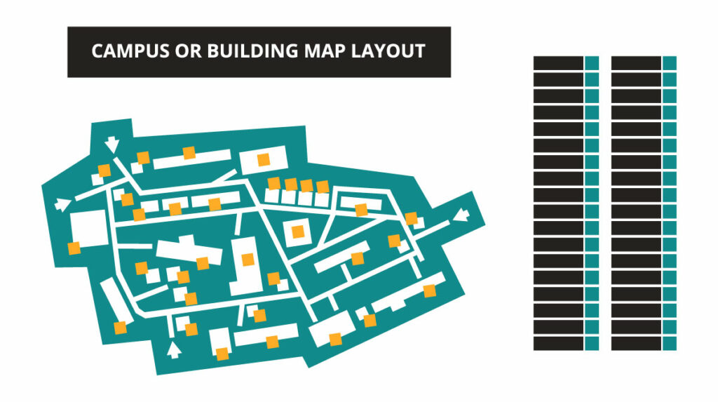
Just like large shopping areas, university and college campuses are often large and confusing, and have both indoor and outdoor components. Digital interactive maps of such campuses can largely help students, faculty members, and visitors while moving around in the campus. With the ‘power of where’ (provided by campus maps) in their hands, students can enjoy a stress-free experience at the campus when it comes to locating an upcoming class or a nearby food vendor.

Why Campus Maps?

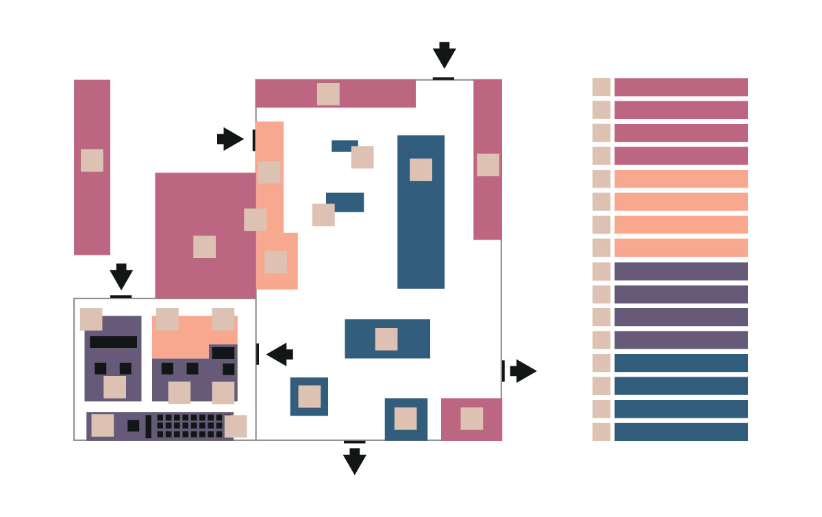
Campus maps provide an interactive display of the grounds of schools, universities, hospitals, manufacturing facilities, apartment complexes, parks, and more. They become an easy tool for students, visitors, employees, or residents to easily navigate the area. For these maps to be actually effective, high level of precision is a given requirement. 

At Magnasoft, we have successfully designed highly accurate campus maps for a large variety of campuses from universities to hospitals. Our expert team works closely with the stakeholders to ensure that the map is accurately customized as per the requirements. Our work doesn’t stop at just creating the maps; the team works with you to ensure that the maps stay updated with the latest information at all times. 

Vital Factors to Consider

For a campus map to evolve as an efficient visitor management tool, the map design process must keep in view the following factors:

Clarity and accessibility of information 

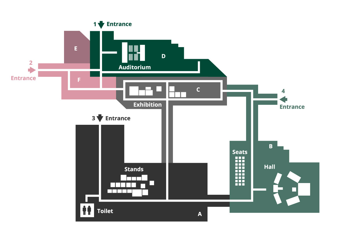
Not only do the maps need to be accurate but they must also consider the requirements of people with special needs such as the visually impaired or people who need a wheelchair to move around. The campus map must clearly detail where steps or wheelchair access are located, along with the accessible entrances.

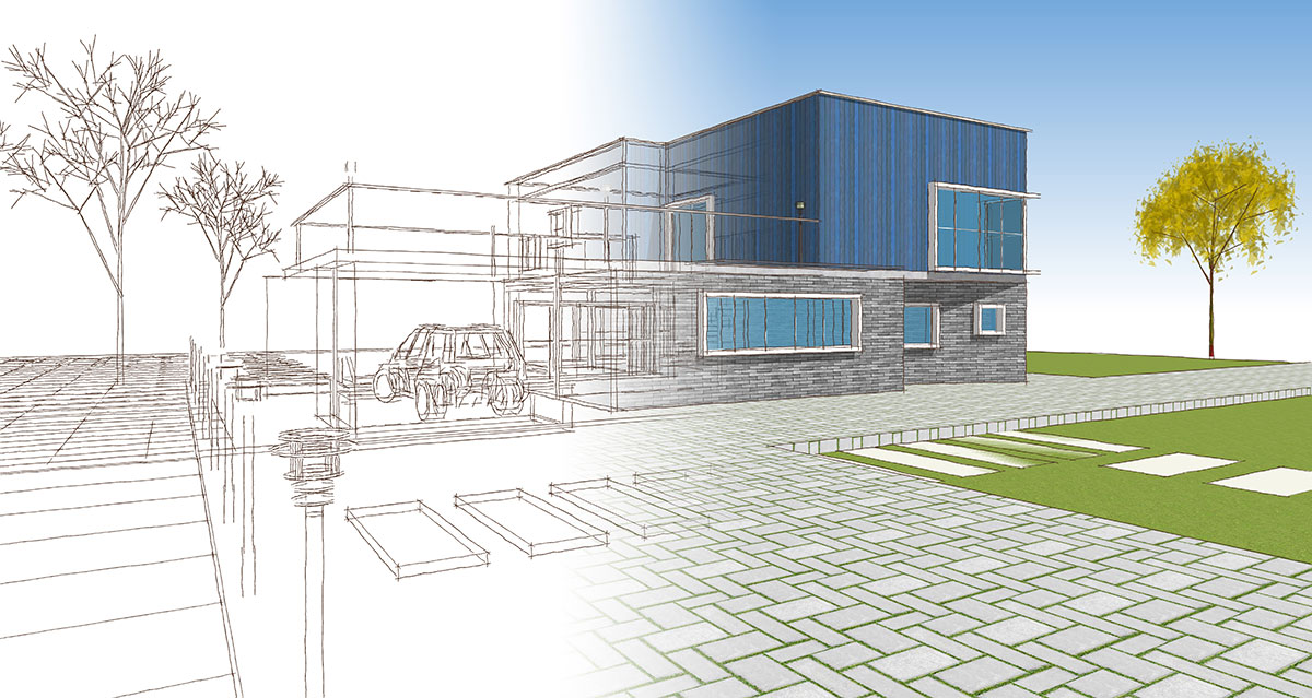
3D buildings have the potential to take orientation and wayfinding to new levels. Specific illustrated buildings and Points of Interest can make the mundane campus maps interesting, enabling the visitors to engage with the maps as well.

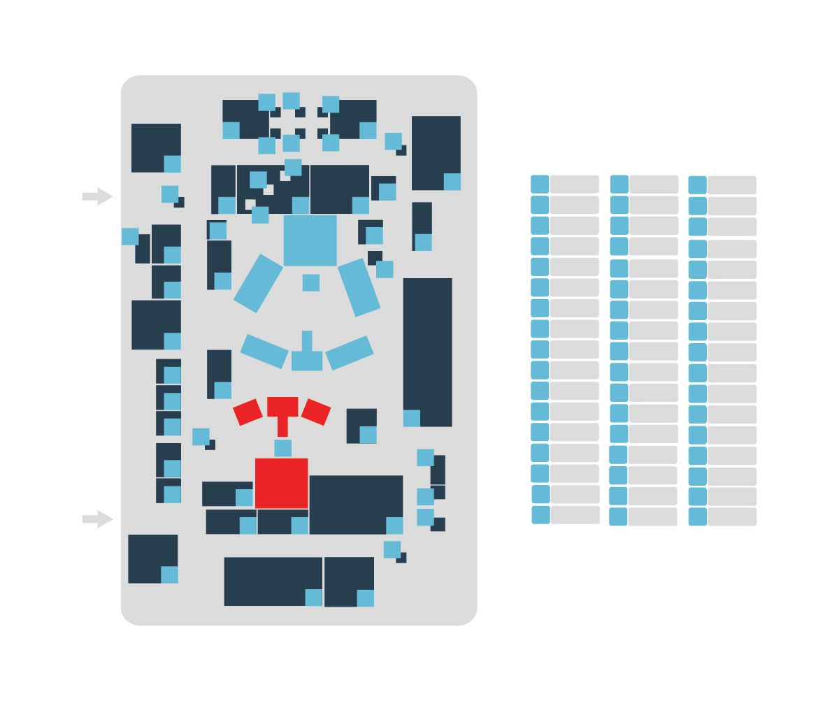
It is also a good cartographic practice to use different colors to differentiate between different campuses or facilities within a single site, for example clearly marking Residential Halls from Class buildings. 

Importance of size and scale

The map content should be legible in all sizes. It should allow flexibility in displaying and hiding information. For instance, the information the map holds for pedestrians may not be of much use to drivers, so they should be able to hide that information. The mapmaker should strive for creating a single map which can be repurposed for varied groups.

Stakeholder involvement 

A campus map is a very personalized product. Thus, it is necessary to involve the stakeholders from the very beginning of the process. The suggestions and feedbacks must be implemented to reestablish the fact that a campus map is a way to reinforce the identity of the campus.

Consider adding value 

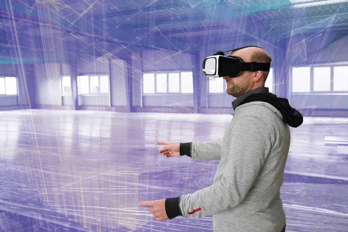
A robust map should not only carve out the routes within the campus with precision but also consider making additions that will make the life of the users easier. For instance, it is a good idea to include details about local transport facilities, local town centres, rail stations and supermarkets to make things easier for people visiting the campus. Making the map AR/VR ready is also a great way of enhancing the user experience.

Conclusion

Magnasoft’s interactive campus maps allow students, faculty members and visitors to easily locate buildings and the rooms and services within them. Our mapping capabilities are not limited to universities and schools but have stretched over to large complexes like hospitals, shopping malls etc.

All large campuses and multi-building facilities must consider strategically placing signs and creating accessible precise digital maps of their campuses. A well created campus map serves as a visitor management tool, helping visitors to reach their destination effortlessly. An indoor campus map can provide the visitors, staff, students, and anyone else an enhanced campus experience. Along providing useful information, it can allow the users to engage with Points of Interest. Campus maps can also significantly aid in public safety and emergency management. They can help the staff in training and incident planning. 

The benefits of having detailed digital campus maps are many, however, for effective outcomes, it is necessary to choose the right partner for the purpose of creation and updation of these maps.

Also Read: Why 4D BIM?

Why Constructioneering?

What is Constructioneering?

Constructioneering allows engineers to work with an accurate 3D model of existing construction site conditions. These models are thereby processed into engineering-ready 3D reality meshes. With the help of latest technologies such as cloud computing, the engineers’ work is directly conveyed to the construction processes in the field. This leads to better coordination between the teams and consequently better outcomes.

In traditional workflows, data in the digital engineering models is often not only lost but also inefficiently recreated between design and construction. Constructioneering enables the stakeholders to overcome these inefficiencies by providing seamless integration for constructible models. These models provide real-time updates and offer data exchange, leading to enhanced efficiency and reduction in cost.

Constructioneering Benefits

In construction projects, when a design is handed over to the next stage, such as from designer to builder or builder to asset manager or owner, a large amount of data is passed on. To ensure that the information and design is accurate and up-to-date, often a lot of rework is required. This mainly happens because the projects are delivered in 2D construct and design PDF and then the design model for construction are created and put it into another format for the asset managers. This process involves a lot of data remediation and rework.

Constructioneering is a path towards working more efficiently, towards automating workflows. In view of the growing demand for infrastructure project delivery globally against finite resources including an aging construction workforce, ‘going digital’ becomes necessary. In these times, adoption of constructioneering can significantly make the work of surveyors, engineers, and constructors automated and more valuable throughout the project lifecycle.

Constructioneering has the capacity to make infrastructure projects more lucrative. However, it remains a challenge to motivate and empower the historically conservative engineering and contracting firms to adopt the going digital approach including constructioneering. 

Hybrid Workflows

Constructioneering allows combining different methods of surveying as the data collected using different means can be clubbed into one model. For instance, for a big road construction project, the data capture can happen through traditional surveying tools as well as drones. Putting constructioneering in place, all the data collected through different methods of surveying can be combined into one model.

Enhanced Connectivity

Constructioneering, which is a sub-activity in BIM strategies, helps the industry overcome the difficulties in sharing information between different phases of a project. It allows sharing of project information through a connected data environment (CDE). CDE allows handing over of information from the designer to constructor to asset managers as one complete package. 

Constructioneering is all about breaking down the inefficiencies of transferring information between engineers and construction contractors. It helps in filling the gaps. 

With constructioneering, it is possible to send the 3D constructible model to an active project site. This enhanced connectivity between the model and the assets on site enables the project designers and constructors to have a clear and accurate design of the project in real-time. This also helps in regular quality checking during the project lifecycle.

More Transparency

By providing seamless connection between data and workflows, constructioneering enables all stakeholders to have more transparency during the construction process. Constructioneering allows every stakeholder to give input and understand what’s going on. A connected environment allows stakeholders to easily point out why something in the design may have changed. As the change is captured over time, it becomes easier to understand why and how the deviations occurred between the design and the final project. This information can help the contractors to improve their delivery in the future.

Conclusion

The construction industry is one of the least automated industries in the world. It is extremely segmented as the stakeholders often work in their individual silos. In contrast to this individualistic approach, Constructioneering provides a holistic alternative; an overarching approach to automating the entire workflow, including all the silos, instead of just focusing on one particular area (usually the one that customers are involved with).

As new infrastructure demands increase and new challenges arise, it becomes necessary to have effective conversations between designers, engineers, and asset managers. The construction industry needs to largely diversify the way it delivers projects and constructioneering is an excellent way of pushing the industry forward. It is the right step to take if going digital has to become a widespread reality in construction. 

Also Read: The Rising Era of Proptech

Top Trends in Construction Technology

Technologies like smart machinery, big data, virtual reality, augmented reality, IoT and Blockchain are the top ones which are driving the construction industry. Adoption of these technologies is largely enabling the industry to achieve improved working conditions, more efficiency, better health, higher safety at workplace, less wastage and more.

Major technologies driving construction

The major types of construction technology that are largely impacting the industry are the following.

Big Data

Data is the most valuable resource today. About 2.5 quintillion bytes of data is created each day currently.  These large datasets help in discovering hidden trends and behavioral patterns, which help the stakeholders to make more informed business decisions. 

Big data largely helps the construction industry as well. By analyzing historical big data the stakeholders can pick out patterns and probabilities of construction risks. This information can help them steer new projects towards success and avoid failures. Optimal phasing of construction activities can be done by analyzing data from weather, traffic, and community and business activities. This data when fed into building information modelling (BIM) systems also helps in scheduling maintenance activities in a better way.

Artificial Intelligence & Machine Learning

Artificial Intelligence (AI) and machine learning (ML) are fast becoming important technologies for the construction industry.  These technologies are allowing the industry to save time and cost in processes, leading to higher efficiency.

AI and ML helps in predictive designing, creating digital building twins and designing alternatives. AI can help in doing away with repetitive tasks leading to better productivity. Machine learning facilitates exploration of different variations of a solution. It helps in creating design alternatives. These designs take into consideration the mechanical, electrical and plumbing (MEP) systems and ensure that the routes for MEP systems do not clash with the building architecture. Thus, we have clash-free designs. AI technologies also ensure increased safety on construction jobsites. Using AI, the sites can be monitored for safety hazards. 

Internet of Things (IoT)

The use of IoT in construction can largely improve the productivity and outcomes. IoT helps in making the workplaces safer. Wearable IoT devices help the employees to stay safer during work. Continuous information about the movement of employees through wrist bands or clip-on devices can be used to discover any risks and accordingly warn the staff.

Use of IoT devices can also make significant improvements in resource management in construction. Onsite, sensors can aid in monitoring things like unusual vibrations on a piece of machinery making it easily identifiable for fixing. Even increase in humidity can be detected telling the crew about damp issues and the devices can even help in preventing fires.

Drones 

With construction sites becoming smarter, drones are getting used more and more onsite. Drones aid in monitoring sites and identifying danger areas. With the help of the technology, the construction manager can get a quick view of the site without being physically present at all times. The crew can also use drones to deliver materials to the site.

Virtual Reality (VR) / Augmented Reality (AR)

Moving beyond gaming and entertainment, Augmented Reality is creating waves in construction. It is helping the stakeholders to achieve excellence in all phases of a project’s lifecycle, right from project planning to communications. It is helping in winning projects, achieving better collaboration with team members and even improving safety.

Virtual tours allow client to have direct access to site progress without getting mud on their boots! A virtual walkthrough leads to more meticulous planning, such as deciding where materials should be laid, where walls should meet and where doors should be placed. Walkthroughs can also help in understanding the routing services such as HVAC ducts, water pipes and electrical conduits better. AR can help in early identification of the design issues, thereby saving time, cost and efforts. 

AR can help in achieving good collaboration between the teams without the need of everyone being present on the site at the same time. Errors can be reviewed in real-time and consensus can be achieved in a better way using AR/VR. 

Blockchain

Blockchain technology can make the processes more efficient in construction. It provides the benefits of predictive asset maintenance, smart contracts, proactive third-party oversight, faster payments, instant collaboration, better managed supply chains and more.

Blockchain technology also leads to more transparency during the construction process. This transparency leads to improvements in workflow, more collaborative working, timely decision-making, risk minimization and lesser conflicts.

Overall, 2021 is seeing increased adoption of new-age technologies in construction. These technologies are bringing in more efficiency in terms of cost and time. The outcomes are also of higher quality. Data lies at the heart of most of the technological developments and experts like us can help the industry have access to rich 3D data all the time.  

Also Read: The Rising Era of Proptech

The Rising Era of Proptech…

PropTech has brought in a radical shift in consumer experience and construction development. Thanks to technology advancements and their adoption, the real estate industry is reinventing business models and revolutionizing like never before. By leveraging PropTech, the industry is becoming future-ready.

What is PropTech?

PropTech refers to an innovative approach adopted by the real estate industry wherein it uses latest technologies to optimize the way people research, rent, buy, sell, and manage properties. The integration of cross-industry technologies brings large-scale benefits to all the parties involved – developers, investors, and property management companies. Technological infusion also enhances customer experience. Smart buildings are one of the direct outcomes of the increasing adoption of Proptech by the real-estate industry. 

The benefits of this change are huge and that’s why the global markets are witnessing it at a large-scale. The Covid pandemic has also given PropTech a big push. The real-estate industry is witnessing a lot of technology infusion in the form of Building Information Modelling, Artificial Intelligence, Machine Learning, Internet of Things, Augmented and Virtual Reality, Fintech and Crowdfunding, Big data and Blockchain. The use of technology is happening at different stages of project execution. This increased use of technology is enabling the real-estate business to move forward with real time data insights, leading to more informed decisions at all stages of property management. 

As the industry inclines more towards Proptech, investments in the segment will see a rise.

The Rising PropTech Industry

PropTech companies are efficiently addressing the pain points of the real-estate industry by introducing innovations into each step of the processes and revitalizing the existing systems. According to the KPMG Global PropTech Survey, the digitally-driven PropTech industry has made considerable progress over the past several years. The findings of the research are very encouraging. According to it, 58%of the real-estate business has already embraced some digital innovations and there are about 6 US PropTech startups for every one million people.

As per a recent research conducted by Deloitte, the US leads in the presence of PropTech companies, followed by Europe. PropTech is definitely going places!

Smart Buildings

Increased adoption of Proptech has led to the emergence of smart buildings. The use of interconnected technologies to make buildings more responsive, sustainable and productive is the baseline for smart buildings. These buildings along with contributing to energy efficiency and automated detection of anomalies in the building infrastructure, aid in prediction of maintenance requirements. A research by Research and Markets indicate that by 2023, the global IoT smart building market will reach $51B USD globally. A part of this IoT smart building market will be powered by Artificial Intelligence (AI) technologies, about 33%.

Data Driven Services for Building Optimization

As the concept of smart buildings gain momentum, high-quality data driven services that could effectively solve tough building problems would be the need of the hour. The companies offering such services, by utilizing data from existing control systems, should be able to implement cloud-based analytics to identify, diagnose, and develop reports on potential building performance and service issues. Preventative maintenance plans based on the analytics would allow the building design stakeholders to identify and correct equipment issues and improve the buildings’ performance and overall efficiency. 

Conclusion

It is quite evident from the discussion above that the real estate industry can no more ignore the adoption of the latest PropTech. This is necessary if the companies are looking at growing their business at full scale. Concepts like smart buildings are becoming popular, and accordingly building service & solution providers have to hone their capabilities to make impact. Deep domain knowledge, vast experience in engineering & building management services and an innovative mindset remain the key driving factors for the service providers to match up to the new standards in PropTech & AEC.

Also Read: Digital Twins: Promising Excellence in AEC

Why use 3D Models?

3D Modelling provides evident advantages when used for AEC. The application converts the cluttered labyrinth of infrastructure meshes into a straightforward and easy-to-understand 3D visualization. It allows businesses to make collision-free plans of the infrastructure and facilities, enabling them to plan and coordinate effectively.

Thus, it results in efficient and economical use of their resources in addition to potential financial gain. Citizens also profit from a better service that minimizes the interruption in their daily living. 

The importance of 3D Models can be looked through the following lenses.

Realistic, Quick, and easy

With 3D models, you can show your project more realistically. Designers can evaluate the project from different angles before finalizing all the essential aspects. Also, the technology allows them to make any changes before making the prototype. Additionally, 3D models provide the quickest way to detect the flaws in your project. 3D Modeling enables a designer to concentrate more on the creative essence while saving a lot of time and money.

Expand the Design

With 3D modeling software, it is easy to design any feature. In other words, it helps to design different shapes of your own choice. Not just shapes, but you can also make complex patterns with just a click. Designers who lack use of 3D modeling techniques face the issue of clearly representing their ideas. 3D modelling brings unmatched precision and creativity in the projects. 

Easy Correction and Remodeling

Making any minor or significant changes in your physical project is next to impossible without any 3D model. With 3D Modeling, it’s easier for designers to inspect the overall design. If the designer thinks the project needs remodeling, he can easily do it with 3D Modeling software without any additional cost. Design errors which can eventually lead to huge losses also get easily identified in the models and can be rectified early on.

Increased Quality and Efficiency

One of the exciting applications of 3D modeling is in a combination of 2D techniques. The combination helps designers to explore new creative workflow that increases efficiency and productivity. It also helps to showcase the quality of the work better to a potential customer. The application also features a combination of hand-drawn sketches with 3D effect in a single picture.

Better Project Approval

With 3D models it’s easier to satisfy the prospect. The prospect can see even the minor details the designer has worked on. However, with 2D drawings, it isn’t possible. Hence, 3D modeling offers higher chances of approval and changes as per the prospect without investing much time.

Accurate Measurements

A 3D Model displays the physical dimensions of a project and its distance from another object in the total layout. It helps the prospect to see and adjust arrangements based on the size of the project. The application also makes it easier for the designer and the prospect to work together, making communication easier.

Conclusion

Any design that exists in the built world needs a foundation in 3D modeling. Having a 3D data model during the design process improves the understanding of a project, which is crucial for all the stakeholders. The information contained within a 3D model enables builders to coordinate utilities, grading, and system routing information accurately.

With 3D modeling, designers are able to create more accurate designs which ensure the project functions properly and lasts for decades. The more accurate the information is from 3D model, the higher is the quality of the final project. 3D models also allow projects to meet building codes and requirements for functionality that are critical for both owners and users of a building.

Why Magnasoft for 3D Modeling?

Magnasoft’s in-depth understanding of 3D modeling techniques coupled with vast experience makes it a preferred partner for diverse industries for their 3D modeling work. A cross-trained, flexible workforce, and a dedicated QA & QC team ensures superior output quality.

We have created highly accurate 3D models for leaders in AEC, Oil & Gas, Land Administration, Utilities, Autonomous Driving, and many other industries.

Through advanced techniques, experts at Magnasoft help in utilizing the 3D modelling technology for the most effective outcomes that have brought a lot of relief to the sore areas. Our vast experience allows us to understand your pain points effectively and provide solutions that meet your goals optimally.

Also Read: Spatial Intelligence is at the Centre Stage

Growing Importance of Indoor Mapping

Indoor location mapping is a name that indicates the mechanism, which allows positioning objects and people in closed environments. Indoor mapping software allow sensors to track  internal environments. Sensors in certain spots work together to collect information, which helps businesses to obtain data in real-time about what’s happening in a closed environment. This knowledge helps in better decision-making and providing enhanced user experiences.

How does indoor mapping work?

Indoor mapping technology is a combination of different technologies, GPS, Wifi, and Bluetooth. Together, they work to help businesses identify users’ positions (device carriers), specific destinations, and other assets. Due to the lack of precision in previous technologies, indoor mapping focuses on combining the previous mechanisms with sensitive technologies – vision, footprints, head points, etc.

Businesses can obtain satisfactory results by deploying a combination of varied technologies that mainly includes:

Proximity positioning: It is based on direct contact or a range of proximity between a receiver and a device. One of the common examples using proximity position is the distance between wifi and a smartphone.

Trilateration positioning: This technology involves determining a position by knowing an object’s distance from at least 3 known points. The reference points are radio wave emitters that use signal strength to determine the distance between two objects.

Fingerprint positioning: Fingerprint positioning technology leverages signal strength measurements across different venues determining the position of an object. These signal strengths are mainly measured, along with coordinates for each, and then saved to a database.

Motion positioning: The technology uses smartphone technology to measure components. Accelerometers, gyroscope sensors, and magnetometers are the three components to measure, determine, and calculate the position in a physical space. Data used through these mechanisms provide accurate device coordinates.

Near-field Communication: Near-Field Communication (NFC) is a technology that can strategically be placed throughout venues. NFC Internal enables an easy data transfer for indoor navigation systems just by touching tags spread over a building or a complex. 

Bluetooth low energy devices: These devices are small battery-powered devices that emit Bluetooth signals, making it possible to establish an object’s location accurately.

A few common technologies: Other technologies included are visible light communication, ultrasound devices, and wifi access points. All these technologies work together with various applications to identify and track an asset’s position.

Benefits of indoor mapping

Within a large complex building, navigation typically relies on building signage, information from kiosks and getting assistance from information desks. With advancement of mobile devices and wireless technology, indoor positioning systems are providing more enjoyable experience inddors. Indoor mapping technology is largely helping in navigation in closed environments. 

Some important benefits of 3D indoor mapping are:

Fastest routes: Indoor mapping tools allow calculation of the fastest route between two points. You can apply it in stores and shopping centers, where you can quickly locate any person or asset from your device—the greater the size of the establishment, the greater the utility of these applications.

Crowd management: Knowing the exact location of people and objects in real-time can allow us to know which points have more agglomeration. Thus, the technology helps us to discover the alternative routes. Additionally, such information can help the authorities to better manage crowds and avoid possible chaos in case of emergencies.

Improves decision-making and user experience: Data collected in real-time help businesses to improve the decision-making process. Better traffic management helps customers to have a better experience indoors.

Popular application areas of indoor mapping solutions

Indoor mapping technologies allow you to position objects and people in closed environments. The features of mobile indoor mapping are especially essential in hospitals, airports, shopping malls, etc. since at any given point of time, these buildings house a lot of people. Indoor mapping helps in better crowd management and easy navigation.

Shopping Malls

One of the most popular uses of indoor mapping is in shopping malls. Be it locating stores or finding the hotspots of sale, a handy indoor map enhances the shopping experience multifold. The technology can guide the shopper with real-time turn-by-turn navigation. Businesses can enhance the user experience by including more details in the indoor map, such as prices, stock, and promotions. It not only saves time but also helps the workers to fulfill orders more efficiently.

Indoor maps also help in easily locating the emergency routes in case of fire or any other emergency. Keeping in view these benefits of indoor mapping technology, more and more shopping malls are adopting the same. 

Stadiums

Stadiums are complex facilities that use plenty of indoor mapping software. The solutions can tell visitors precisely about their seating area, show line lengths, and guide them to the correct location. Stadium owners can use this technology with the flexibility you need to update maps quickly.

Office Spaces

Smart office buildings are moving towards indoor mapping technology with wifi integrations and mobile apps to enhance the user experience. Indoor mapping tools can help you to set up the workspace more efficiently with changing layouts for more productivity.

Moreover. indoor mapping solutions allow businesses to easily visualize their workplace and make adjustments that adhere to social distancing guidelines. Firms can make edits to their office floor plan using this technology and experiment with different layouts.

Parks

When it comes to using indoor mapping services, parks also need them to enhance the visitor experiences. Users can use the maps to enter their destination in the app and follow the directions. Using the indoor maps, parents can quickly reunite with their children in case of emergencies.

Why Magnasoft for indoor mapping?

Magnasoft offers a broad set of indoor mapping technology services to capture location data that underpin 2D and 3D indoor maps to support business-critical decisions. We work closely with IoT manufacturers. This helps us to understand the business needs and provide the best possible solution to a business problem. With 5,000+ projects completed of airports, campuses, manufacturing, and processing plants, we are known as one of the best indoor mapping companies. We take pride in providing the best 3D indoor mapping services for leading mapping companies of the world and public and private indoor places at global level. 

Also Read: Actually Gliding Through!

Why immersive experiences need 3D data?

The major technologies that are used to create immersive experiences include the following:

Augmented Reality

Augmented reality (AR) refers to an enhanced version of the real physical world. This is achieved through the use of digital visual elements, sound, or other sensory stimuli delivered via technology. AR uses technology (like a camera and screen on a smartphone) to add a computer-simulated layer of information on top of the real world. 

Virtual Reality

Virtual reality (VR) is a simulated experience that can be similar to or completely different from the real world. Applications of virtual reality include entertainment (e.g. video games), education (e.g. medical or military training) and business (e.g. virtual meetings).Google’s Expeditions is a great example of mobile VR in action.

Mixed Reality

Mixed reality is the merging of real and virtual worlds to produce new environments and visualizations, where physical and digital objects co-exist and interact in real time. Mixed reality does not exclusively take place in either the physical world or virtual world, but is a hybrid of reality and virtual reality. 

Digital Twins

A Digital twin is simply a virtual replica of an existing asset, which converges real-world data with the virtual world to provide output in 3D form. They are produced by specialized digital twin companies that use digital twin software to realize such complex models. Today, digital twins are primarily used for evaluating the asset and documentation purposes. But this is only the beginning: digital twins will be enablers for many new applications and technologies, enabling new experiences, products and services. One example of the potential of digital twin technology is their connection to the physical space through the use of sensors, which will generate real-time data for measuring the lifecycle of an IoT device. A digital twin enables creating and monitoring of large IoT networks that are directly connected to physical space – realizing a true smart city that monitors and corrects itself using Artificial Intelligence.

3D is the backbone of actual immersive experiences

All these technologies need 3D data to actually provide the experience they promise. However, a lot of the VR and AR you see today is actually using 2D or 3 degrees of freedom (3DOF) data.

High fidelity 3D data is difficult to produce and this makes brands to go for sub-standard 360 or 2D content. 2D content is sometimes just layered over a 3D scene. What’s more? Many headsets, typically in case of mobile-powered VR are actually unable to support anything more than 360 content. Only 3 degrees of freedom (3DOF) are supported by them. Needless to say, the experiences so created are far from matching reality. VR is a great innovation, but in the absence of good quality 3D data, implementations are made using mediocre 2D data. The outcomes are often disappointing for end users. 

This brings us to the inevitable: To properly implement VR or AR, you need high quality 3D data.

This is simply because we live in a 3D world, and reality is 3D. When we say 3D here, we mean objects that look and feel real because they have volume (volumetric 3D); they can be seen from any angle, and we can even pick them, thereby getting a sense of their weight. This helps in creating a more immersive experience. 

Immersive experiences simulate physical environments. The goal is to create something even better than the in-person experience. Brands are using immersive technologies to create experiences that can make every phase of the purchase journey of the buyer more captivating and insightful. The user must feel connected. For instance, on its website, Emirates uses VR technology to offer 3D models of the cabins. Such models help the travelers to make informed choices while selecting their seats and preview the environment, thereby enabling them to make the most of their on board experience later. 

 WebXR – re-defining web content

3D on the web provides much more immersive experiences than images or videos. It is the WebXR technology that has made the arrival of immersive social media possible. The ‘XR’ stands for Extended Reality, which describes the family of immersive technologies including Virtual, Augmented and Mixed reality. You don’t need a VR headset to experience the Immersive Web. You only need an updated browser! Today, many of the leading browsers, such as Chrome, Firefox, Microsoft IE and IoS Safari support WebXR. By using 3D on the web, brands can reach a much larger audience, almost 100 times more.

3D consumed on a 2D screen is surely not as immersive or as captivating as true VR/AR. Only high quality 3D data can provide your users the experience they are expecting from VR/AR. So, don’t comprise on your data for immersive technologies. Choose the right partner today to effectively meet your 3D data goals…

Also Read: Information in three dimensions is more trustworthy

Top 5 trends in the Telecom Industry

Trend #1: 5G

5G is all about reliably connecting things everywhere without any delays. This ultrafast connection will enable people to measure, understand and manage things in real time. The 5G technology will enable businesses to get real-time insights like never before. With the use of this technology businesses will have total control over their products, services and assets. 

It is estimated that 5G will generate $700 billion in economic value. Leading telecom companies are in advanced stages of acquiring the technologies and licenses for 5G rollout. However, in today’s dynamic scenario, it is not enough for telecom companies to just provide a network. They must integrate 5G with advanced technologies like edge computing, IoT devices, etc. 

Trend #2: Internet of Things (IoT)

Telecom companies can amplify their service portfolio with a range of IoT-enabled services. IoT products and services will become especially useful as the 5G networks mature. IoT solutions such as smart metering can provide utility companies measurable value. Such solutions allow utilities to have easier access to information, and provide them with better ways to manage data. Using IoT, utility companies are able to drive their efficiency and lower operational costs. 

Integration of IoT & geospatial leads to better outcomes for the telecom companies. IoT devices can be used to monitor the telecom infrastructure and maintaining them. They continuously keep transmitting information about the health of assets and thus aid in quick resolve of issues and providing better services. They can help in early identification of equipment malfunction, power outages etc. and result in immediate action. 

Understanding these benefits, telecom services providers have already started leveraging the IoT technology. The technology is enabling the utility industry to achieve significant improvements in customer retention as well as customer acquisition. 

Trend #3: Edge computing

In telecom, edge computing is often referred as Mobile Edge Computing, MEC, or Multi-Access Edge Computing. Edge computing offers the benefits of low latency, high bandwidth, data offload and trusted computing and storage along with bringing the networking close to the end users. The networks are typically within or at the boundary of operator networks.

Edge computing also allows networks to be placed at enterprise premises, for example inside factory buildings, vehicles and homes. The communication service providers or other types of service providers can manage the edge infrastructure. Many times, use cases require different applications to be deployed at different sites. In such a scenario, a distributed cloud becomes useful. It can function as an execution environment for different applications spread over multiple sites. This includes managing connectivity as a single solution.

Research indicates synchronization of edge servers with telecommunications infrastructure presents an opportunity worth approximately $54 billion.

Trend #4: AI, ML

Advanced technologies like artificial intelligence, machine learning and deep learning are bringing new levels of efficiency in almost every industry. The story of telecommunications is no different. The expanding scope of 5G applications is likely to put a lot of demand on the networks; high availability, ultra-reliability, low latency and high security, being the main areas of focus. This growing complexity will drive the need for more automation. Intelligent agents capable of handling complex processes will be required to optimize a network in multiple steps.

 The next-generation wireless networks will use data science and machine learning for making predictions related to peak traffic and enhancing network capability. AI/ML based data analyticswill allow telecoms to boost network performance and reduce cost.

Trend #5: Cloud Computing

We are aware that the telecom industry was moving gradually with the cloud. However, cloud has become a priority for the sector due to the rise of 5G, pandemic initiated unprecedented spike in data traffic and rise in broadband services. Telecom companies are investing in modernizing their networks and shifting to virtualized and cloud architectures. The telecom cloud market, which was valued at $25.33B in 2020, is expected to reach $74.36B by 2026.

The shift is desirable since cloud computing helps telecom companies to be scalable, resilient and better prepared for disasters. The company can face data loss due to a power outage at a data center or a security breach. However, if it has backups of databases stored in the cloud, the data can be quickly restored. Use of cloud also helps in reducing costs. 

The cost of setting up and managing a data center is high as it involves the cost hardware, software, servers, energy bills, IT experts, etc. This cost is significantly reduced with cloud infrastructure, since the company only pays only for the services it uses. Data management, sharing data and data analysis for important insights becomes much easier with cloud. 

Better control over operations automatically lead to enhanced customer experience with cloud computing as it helps in minimizing latency, providing automated customer support, predicting customer preferences and offering new digital experiences.

Conclusion

Telecoms are shaping a new reality for companies by leveraging the strength of advanced technologies like 5G, edge computing, artificial intelligence etc. We are excited to be a part of this growth story which is drastically changing the way we communicate and exchange information. 

Also Read: Spatial Intelligence is at the Centre Stage

Don’t be locked out of your data…

Keeping in view the numerous benefits autonomous vehicles promise to bring to the environment and humans, auto manufacturers as well as tech-savvy outsiders are investing billions of dollars into the development of the magical vehicles. With this trend, the automotive industry has entered into an accelerated mode of innovation, making the delivery of self-driving vehicles a top item in the ‘to-do’ list of leaders in and out of the industry.

However, everything is definitely not going as planned…

Challenges slowing the pace?

Just like any other major disruption, the autonomous vehicles (AV) sector is also facing numerous challenges which are limiting its growth. One of the most vexing challenges faced by the industry is: how to manage all the data? 

To be able to effectively ‘see’ where it is going, detect and avoid hazards, autonomous vehicles need huge amount of data. For the vehicles to function effectively there is need of efficiently collecting and processing massive amounts of data. The automotive industry needs to unlock the value of data to be able to accomplish the goals it has set for itself in the realm of AVs.

There is an explosion of data in the automotive industry due to the continuous flow of vehicle information. Connected cars are publishing large datasets at an incredible rate. Research indicates that one test autonomous vehicle generates up to 4 terabytes of data. This data is an amalgamation of information about the vehicle and real-time data about the environment such as weather, road conditions, other vehicles, pedestrians, street signs etc. The data, along with enabling the vehicle to make instant driving decisions, helps the manufacturers to identify new driving conditions and prepare the vehicles for the same using AI and human intelligence. 

It is not an easy task to manage such a high volume of data and have desirable outcomes in its curation and analysis. Efficient processing of such huge amount of data at a fast pace is a challenge that is slowing the growth of the AV industry.

The right data partner

It is critical for the automotive industry to have precise data augmented with human intelligence. Data must be correctly sourced, curated and analyzed to produce expected outcomes during training, simulation and testing. The data must be secure, standardized and able to move flexibly in real-time between enterprise IT, cloud and the vehicle. High quality data can aid in uncovering risks and unlocking new streams of revenue. According to Auto Tech Review, overall global revenue from the monetization of vehicle data could reach up to $750 billion by 2030. 

Thus, the automotive industry must gain control over its data. Instead of solely relying on in-house experts, it is advisable to collaborate with the experts to leave no stones unturned for achieving the best outcomes. By choosing the right AV data management partner, the company can overcome the hurdles in managing large volume of data from disparate sources. Typical test vehicles include over a dozen LIDAR and RADAR sensors, and several video cameras. The data management expert can help you have high quality reference data for training and localized data to test the vehicles in different conditions and geographies. Using its deep domain knowledge and the right tools, it can build a customized solution that can largely help you in collecting, managing and analyzing the massive data streams created and captured by your test fleet. Thus, the advantages of this collaboration are many. 

Conclusion

As a leader in the automotive sector, you must be currently facing several challenges, right from strict regulations and penalties, swelling costs, continuously changing consumer demands to managing huge volumes of data for effectively training the AVs. We understand that. In such a scenario, having a data advantage can help your company peacefully deal with the challenges. Ineffective data management can not only result in out-of-control costs but also limit your growth in the AV sector. 

Data is the key to uncovering risks and unlocking new streams of revenue. To be able to extract value from your data, you need a partner who not only thoroughly understands the industry, but also possesses the necessary skills and knowledge to derive the most valuable insights from your AV data. It should be able to help you jumpstart your data-driven profitability. As an automotive industry leader, you require an affordable and efficient solution to connect your data and extract value from it. Choose the right data management partner today. Unlock the value of your AV data and create a mark in the industry.

Also Read: Data Annotation for Autonomous Vehicles

Why 4D BIM?

Put simply, 3D BIM is the process of creating graphical and non-graphical information and sharing this information in a Common Data Environment (CDE). This information becomes richer in detail as the project lifecycle progresses. 

What’s with 4D?

Now, let’s add an extra dimension of information to the project information model in the form of scheduling data and you have brought the fourth dimension to BIM. Adding this extra information enables the stakeholders to take more timely decisions, and ultimately build better buildings. From 3D to 4D, the dimension of ‘time’ is added to the information model. 4D explains how something will be over a period of time. When you break your 3D model down into pieces which will be built according to a certain schedule, you have brought in 4D to your construction project! 

To give a definition of 4D BIM, “It refers to the 3D visualization model of a construction project including construction scheduling and sequencing.” By adding scheduling data of the project even before the construction begins, 4D BIM empowers the stakeholders to analyze events sequentially using project information and visualization. This early sequencing enables the stakeholders to assess the various possibilities and accordingly take actions to improve project planning and risk management. Visualization of the structure as it gets built leads to huge savings in terms of cost and time as fallacies can get pointed out early.

Enabling location-based scheduling

4D BIM offers better spatial insight than 2D and 3D. 4D BIM can help in maximizing the value of location-based scheduling. Location-based 4D BIM can help in enriching the planning and scheduling processes in a construction project. It also improves communications among stakeholders, resulting in better outcomes.

Managing a construction project is a daunting task. Thus, a single integrated model which clearly projects the ‘when’ and ‘where’ of each construction activity can largely help in determining the correct project delivery approach and execution. Location-based 4D BIM helps in achieving just that.

4D BIM with AI

4D BIM, when coupled with the capabilities of AI can help in achieving extraordinary outcomes in your construction project. Using 4D BIM with AI, stakeholders can visualize the project and experience the progress in real time. 4D BIM with AI leads to better collaboration, higher safety, more streamlined field operations and eventually more time-saving, cost-effective results.

In case of large construction projects such as airports, transit systems, bridges, and tunnels, it becomes a huge challenge to track the progress of each activity. While traditional methods of tracking include generation of a wide range of reports, which are susceptible to errors, 4D BIM AI-based video monitoring solutions can provide sequential animation of all activities. Needless to say, this method of presentation offers a better understanding of the progress. The visual comparison of what was planned against what is done on-site brings in more efficacies in the final outcomes.

Along with infusing more collaboration among team members, 4D BIM with real-time AI plays an instrumental role in reducing on-site risks and injuries. Moreover, since all construction site activities are recorded digitally, the risk of a data breach or misplaced paperwork is removed.

Also Read: Information in three dimensions is more trustworthy

Conclusion

Managing a construction site is a challenging task. It is critical for project managers to have access to the most accurate, up-to-date information from the job site all the time. 4D BIM helps in gaining that information. By adding an extra dimension of scheduling data to the project information model, it enables project planners, architects and other stakeholders to obtain accurate  information and visualizations about the project in real-time. It shows how the project is developing sequentially.

This information becomes very useful in identifying potential issues at an early stage. 4D BIM gives everyone clear visual understanding of every stage of the project, from what is planned to what the finished construction will look like. This clear understanding allows everyone to have better control over the project. 

The world of construction is rapidly evolving and becoming more and more technology savvy. Moving ahead from reaping the benefits of accurate 3D models, it is fast adopting 4D BIM and higher levels. With adoption of 4D, 5D, 6D and 7D BIM in the construction projects, the stakeholders are gearing up to achieve improved site planning and scheduling optimization, seamless coordination among teams, enhanced preparedness at each stage of construction, a more collaborative environment focused on information sharing, reduced delays, and higher safety and efficiency in their construction projects. 

A growth mindset is the need of the hour, and to help you in this digital transformation journey of yours we are keen to offer our expert help. Years of experience spread over diverse projects across the globe give us the confidence to be your best digital partner. 

Also Read: Why do 3D Mapping?

Icon Contact Us
IconTalk to Us